



3 Things to Know
- One more day of extreme heat
- Increasing chance of late-week storms
- End of next week will be a little cooler
Forecast
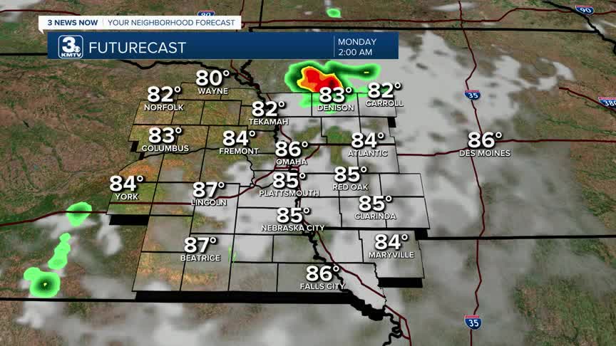
It's extremely hot in the Omaha region this afternoon. Highs have breached the triple digits, with heat indices as high as 115-120 degrees. There won't be much relief overnight as temperatures only fall into the low 80s.
A few storms could develop over central & northeast Nebraska this evening. Not everyone will see a storm, but given the atmosphere, any storm could produce some 60-80 mph winds. We will be dry along & south of I-80.
Monday could be a third day in a row of 100+ degree heat, with a third day of heat indices going above 110 degrees. It's important to check on vulnerable populations, as exposure to repeated days of extreme heat can add a lot of heat stress to the body.
We begin to pull away from the high heat on Tuesday, but it's still hot as temperatures climb into the low 90s. We hold in the low 90s on Wednesday.
Thursday and Friday may bring our next chance at rain and storms. As of now, it looks like they will be scattered, but that can change in the coming days. Depending on how many storms there are, Thursday's high may be kept cooler, in the 80s.
We continue to see seasonally hot weather into the weekend with highs in the upper 80s to around 90.
SUNDAY NIGHT
Mostly Clear
Very Warm
Low: 82
Wind: SE 5-15
MONDAY
Mostly Sunny
Dangerous Heat
High: 104
Heat Index: 112-118
Wind: N 5-10
TUESDAY
Mostly Sunny
Not As Hot
High: 91
Wind: NE 10-15
WEDNESDAY
Mostly Sunny
Hot
High: 94
Wind: SE 5-10
Share your weather pictures with KMTV:
- Email to News@3newsnow.com
- 3 News Now Facebook page
- Use the hashtag #3NewsNow on Instagram or X (formerly Twitter)
