

3 THINGS TO KNOW
- Final round of severe weather this afternoon
- A pleasant week follows the storms
- More rain, not storms, late week
FORECAST
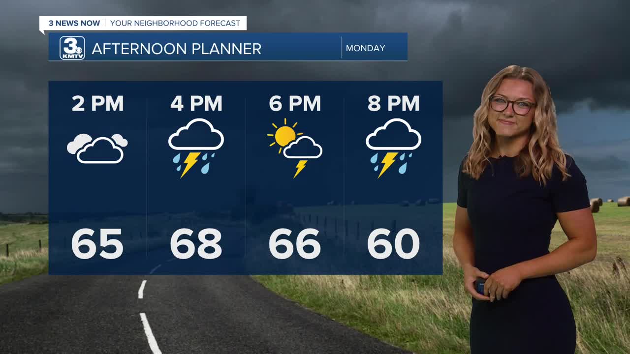
Monday appears to be another significant severe weather day as the cold front arrives. Storms will develop over southeast Nebraska after 2 p.m. and move northeast. The cold front will be very close to I-80, meaning the tornado risk in the Omaha metro may depend on where the front sets up. If the front moves faster, the tornado threat may remain just southeast of Omaha, but that is still too close to call.
Southeast of town, strong tornadoes are possible with any storms that develop, along with the risk for large hail and damaging winds. A line of storms develops later in the evening, still carrying the potential for all severe weather hazards, before exiting the area early Tuesday morning.
The storms should move out by Tuesday, and the passage of the stalled front will bring cooler temperatures by the middle of the week. Highs should remain in the lower 60s with much drier conditions.
With the cooler temperatures, overnight lows early Wednesday morning could allow for areas of frost under clear skies and light winds.
Later this week, Thursday and Friday warm into the upper 60s and lower 70s, with some chances for rain.
The weekend looks warmer and pleasant, with temperatures climbing back into the lower 80s by Sunday.
MONDAY
Partly Cloudy
Severe Storms
High: 70
Wind: SE 5-15
MONDAY NIGHT
Partly Cloudy
Storms End early AM
Low: 47
Wind: SE 5-15
TUESDAY
Partly Cloudy
Cool and Dry
High: 61
Wind: NW 10-25
WEDNESDAY
Partly Cloudy
Cool
High: 63
Wind: CALM
Share your weather pictures with KMTV:
- Email to News@3newsnow.com
- 3 News Now Facebook page
- Use the hashtag #3NewsNow on Instagram or X (formerly Twitter)
