

3 THINGS TO KNOW:
- Warm-up starts this afternoon
- 40s and 50s through the weekend into next week
- Record highs probable on Christmas Day
FORECAST:
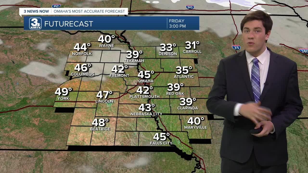
With the breeze, though not as windy as yesterday, it helps to pull back in the warmer air. Thus, highs will soar into the mid-40s this afternoon.
The weekend sees a mix of clouds and sunshine with slightly above-average temperatures, especially at night. Saturday will be partly sunny with highs in the mid-40s. Sunday will be partly sunny with highs in the low to mid-40s.
The holiday week gets even warmer. Monday will be mostly sunny and breezy with mid-50s for highs!
Some extra cloud cover moves in for Tuesday and Wednesday, but we stay in the low 50s.
Christmas Day is Thursday, and Omaha's chance for a "white Christmas" appears near zero...However, we are looking at potential record highs! Right now, we should be near 60 degrees. The record high for Christmas Day is 57, set in 1946.
The next chance for any measurable precipitation would be the weekend after Christmas. Travel disruptions for the region appear low at this time.
FRIDAY
Mostly Sunny
Warmer
Breezy
High: 45
Wind: S 15-30
FRIDAY NIGHT
Mostly Clear
Not as Cold
Low: 34
Wind: NW 10-15
SATURDAY
Mostly Sunny
Above Average
High: 44
Wind: S 10-20
SUNDAY
Partly Sunny
Above Average
High: 44
Wind: S 5-15
Share your weather pictures with KMTV:
- Email to News@3newsnow.com
- 3 News Now Facebook page
- Use the hashtag #3NewsNow on Instagram or X (formerly Twitter)
