

3 Things to Know
- Rain returns Friday and this weekend
- Flooding possible Saturday night
- Below average temps for Father's Day
Forecast
Temperatures for the last few days have been nothing short of awesome, and it looks like we'll bump even lower into the weekend! Now, that being said, our rain chances could start as early as this Friday afternoon, and become more severe as we roll into late Saturday.
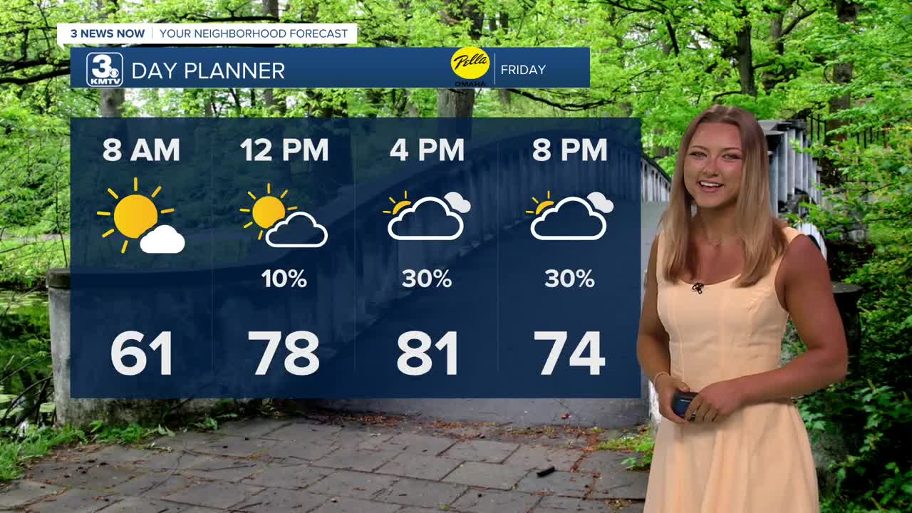
Friday is slightly warmer, and we should start with some morning sunshine. Clouds will take over in the afternoon and there is a chance for spotty rain showers from the afternoon through evening. Highs will be near 80.
Father's Day weekend is looking wet at times. There will be lots of dry-time Saturday morning through mid afternoon and temps will warm into the low 80s with some extra mugginess
After about 4-6pm, a round of storms will develop and move in from central Nebraska, becoming widespread into Saturday night. The Saturday night rain and storms could be very heavy, with around 1.0" to 3.0" of rain possible, which could lead to flash flooding into early Sunday. The severe weather threat is low for the region, but we could see gusty winds in addition to the heavy rain.
Sunday may start out wet before 10am. Some light rain will linger for the rest of the day under cloudy skies. Temps will only reach the mid 70s, if you have the opportunity, take dad for an afternoon stroll once we get some dry time!
Next week continues this stretch of cooler than average weather as temps only reach the upper 70s to low 80s Monday-Wednesday. There may be some more rain around the middle of the week, too.
FRIDAY
Partly Cloudy
Isolated PM Showers
High: 81
Wind: S 5-10
FRIDAY NIGHT
Partly Cloudy
Very Mild
Low: 62
Wind: NW 5-10
SATURDAY
Wetter
PM Storms
High: 82
Wind: S 5-10
Share your weather pictures with KMTV:
- Email to News@3newsnow.com
- 3 News Now Facebook page
Use the hashtag #3NewsNow on Instagram or X (formerly Twitter)
