

3 THINGS TO KNOW
- Spotty light rain/snow this afternoon
- Near record highs later in the week
- Wildfire conditions remain elevated
FORECAST
This afternoon looks to remain quite brisks, with temperatures trying their best to reach the mid to upper 30s with additional precip chances rolling into the area.
Any rain or snow amounts look very low from this, and should bring minimal travel impacts, unless air temps dip below freezing.
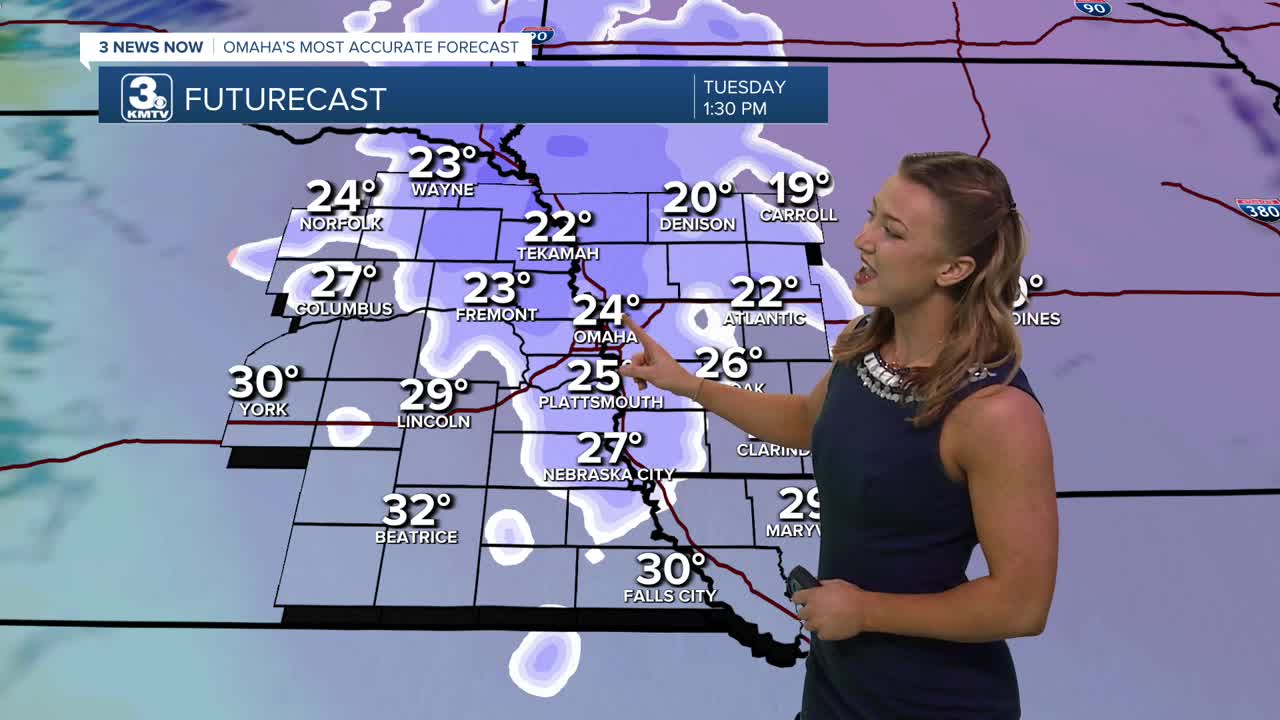
It will be slightly warmer, and a little breezy again Tuesday with gusts out from the south at 25-30mph. Temps will struggle to warm into the mid 30s due to the clouds and rain/snow. Some may reach the 40s closer to Lincoln.
Warmer weather really begins to kick into gear on Wednesday with highs in the 60s and lots of sunshine!
Thursday will be even warm with highs in the upper 70s! Record highs are possible both on Friday and Saturday with 80s for highs.
With the warmer weather likely comes more dry air and elevated wildfire conditions for the region this week.
The second half of this weekend looks cooler, and breezy with highs dropping in the 60s by Sunday. As of now, no rain comes from this cool-down.
TUESDAY
Mostly Cloudy
Spotty PM Rain/Snow
High: 37
Wind: S 15-25
TUESDAY NIGHT
Mostly Clear
Frigid
Low: 30
Wind: S 5-15
WEDNESDAY
Partly Cloudy
Warmer
High: 67
Wind: W 10-15
Share your weather pictures with KMTV:
- Email to News@3newsnow.com
- 3 News Now Facebook page
- Use the hashtag #3NewsNow on Instagram or X (formerly Twitter)
