

3 THINGS TO KNOW
- Rain & snow possible Wednesday
- Getting very warm Thursday and Friday
- More chances at snow late weekend
FORECAST
It will be a cloudy night around Omaha with areas of patchy dense fog. We stay in the low 30s for Wednesday morning.
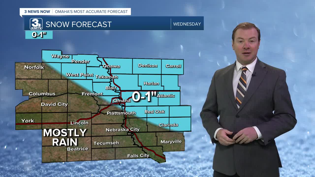
Wednesday starts out mostly cloudy and dry, with temps reaching the 40s around noon. But, after 12pm, a rain and snow mix will move into the area from our north. From Omaha and points east, this rain and snow mix could lead some slushy roads and up to an inch of snow. If you are south or west of Omaha, this is likely just rain for you.
Roads may become a little sick during the evening commute, due to the slush, but should improve overnight.
By Thursday, we are warming out from the cold again and with sunshine, reaching highs in the mid 50s.
Friday will be the warmest day out of this stretch, and looking like a great day with sunshine and highs in the mid 60s, with lighter winds.
By the weekend, it gets cold again...A cold front will move through Omaha late Friday night, and we drop to near 40 on Saturday, and the low 30s on Sunday. There is a chance for additional snow Sunday and into Monday of next week, and some small accumulations may be possible.
TUESDAY NIGHT
Cloudy
Patchy Fog
Low: 31
Wind: NW 5-10
WEDNESDAY
Cloudy
Rain & Snow after 12pm
High: 44
Wind: SE 10-15
Share your weather pictures with KMTV:
- Email to News@3newsnow.com
- 3 News Now Facebook page
- Use the hashtag #3NewsNow on Instagram or X (formerly Twitter)
