

3 THINGS TO KNOW
- Temps gradually incline through the weekend
- Pleasant Valentine's Day, though some may see rain
- Records possible on Monday
FORECAST
The warm weather has not quit for the Omaha region this Thursday afternoon as highs climbed into the 50s and 60s. Tonight, we get chilly as we drop into the upper 20s.
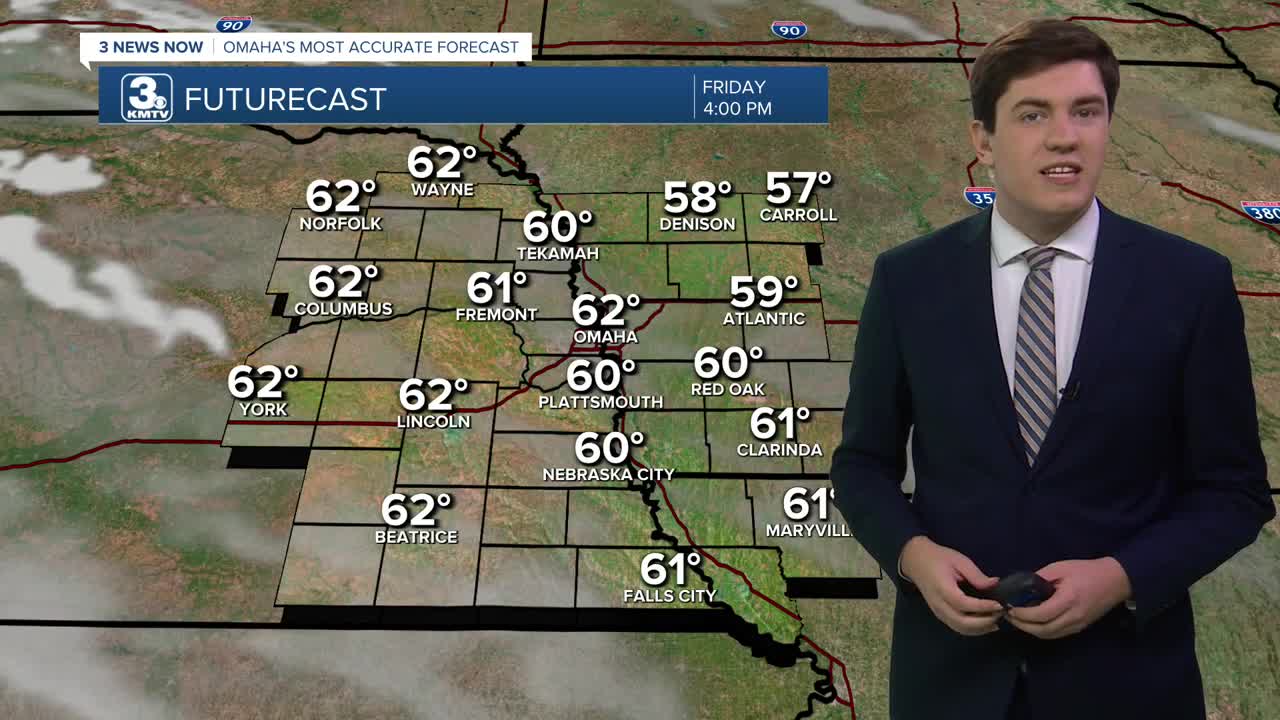
More of us reach the low 60s on Friday with plenty of sun.
While most of us will stay dry on Valentine's Day, a storm system may bring some rain to neighborhoods south of I-80. It's not expected to be a washout, but check the radar before heading outdoors. In Omaha, odds are the city remains dry.
With the sunshine returning on Sunday, we get even warmer with highs cresting the mid-60s.
Monday's record is at risk with the forecast high of 67, which ties the record set in 2017. Tuesday keeps the upper 60s and even 70s going.
The first of a couple storm systems pass by Tuesday evening, bringing a rain shower or two in the evening, though most will be dry.
Wednesday stays warm, in the low 60s.
A second, bigger system may impact us on Thursday with another small rain chance. What may be more impactful, however, is an end to the well-above-average weather by late next week.
FRIDAY
Mostly Sunny
Comfy
High: 59
Wind: Calm
FRIDAY NIGHT
Partly Cloudy
Not As Cold
Low: 37
Wind: SE 5-10
SATURDAY
Mostly Cloudy
Rain Chance South
High: 58
Wind: SE 5-10
SUNDAY
Mostly Sunny
Warm
High: 64
Wind: S 5-10
Share your weather pictures with KMTV:
- Email to News@3newsnow.com
- 3 News Now Facebook page
- Use the hashtag #3NewsNow on Instagram or X (formerly Twitter)
