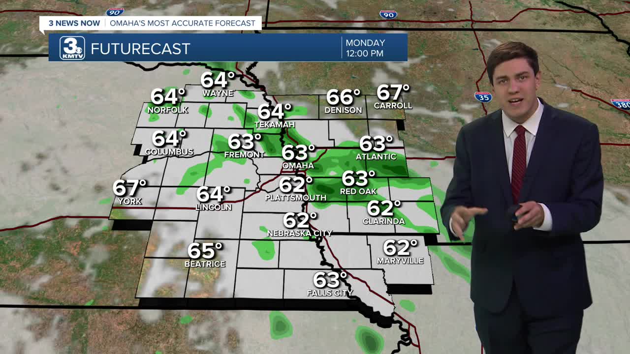


The scattered showers and storms will continue Monday for Labor Day, so have an indoor backup plan for any holiday events you have planned outside. The rain will slowly taper off throughout the day, which may grant enough dry time for any evening BBQs. Highs will be in the upper 60s.
Tuesday will be dry and cool, though we will warm up into the mid 70s.
A cold front arrives late Tuesday night and into Wednesday morning, bringing another chance for rain.
Behind the cold front, we will see another cool down. Wednesday will be in the low 70s, and lows could dip into the upper 40s by Thursday morning.
Thursday may not even reach 70 degrees in the sunshine! A second cold front may bring a few more showers, but many of us will be dry.
We climb back into the 70s for Friday into the weekend.
MONDAY
Mostly Cloudy
Scattered Rain
High: 68
MONDAY NIGHT
Mostly Clear
Foggy
Low: 57
TUESDAY
Partly Cloudy
Dry
High: 76
WEDNESDAY
Partly Cloudy
Scattered Rain
High: 72
Share your weather pictures with KMTV:
- Email to News@3newsnow.com
- 3 News Now Facebook page
- Use the hashtag #3NewsNow on Instagram or X (formerly Twitter)
