

It's a cloudy one for Monday, but it will keep temperatures steady in the mid-50s. Latest trends are keeping Monday mostly dry, though we can't completely rule out a spot shower during this afternoon.
Rain will begin to move in from the west tonight. Most of eastern Nebraska should be seeing rain by daybreak, with it expanding into western Iowa through the morning.
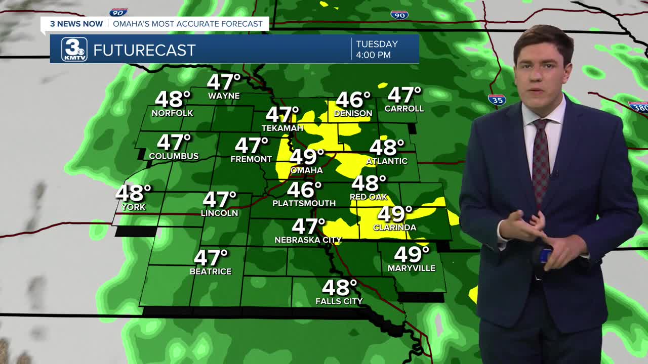
Rain will continue into Tuesday with temperatures in the upper 40s. Confidence is increasing in a soggy day, with light rain falling for most of us the whole day, so bring the rain gear as you head out! Rainfall is expected to be light, but given the extended nature of the rain, it will add up. Some neighborhoods could see 1-1.5" of rain by Wednesday morning.
Tuesday gets windy behind the front, with gusts up to 45 mph beginning Tuesday afternoon, Tuesday night, and into Wednesday.
By Wednesday morning, most, if not all, of the rain will have exited the region. But the storm system stays close enough for another mostly cloudy day. We should see some late-day sunshine. Highs will be cooler than average, in the lower 50s. The average for Omaha in late October is in the upper 50s.
Thursday morning will be cold, and there will be areas around Omaha starting the day below freezing. We see sunshine return on Thursday, and the afternoon will stay cool, in the mid-50s.
Friday is Halloween, we remain dry & cool with highs in the upper 50s. For any trick-or-treat festivities in the evening, temperatures are expected to be in the 40s. For now, it looks dry.
Things will stay seasonably cool for next weekend. It's looking partly cloudy and dry with highs in the mid-50s.
MONDAY
Cloudy
Mostly Dry
High: 58
MONDAY NIGHT
Mostly Cloudy
Scattered Rain
Low: 45
TUESDAY
Cloudy
Rain
Windy
High: 49
WEDNESDAY
Mostly Cloudy
Rain Ends
Windy
High: 52
Share your weather pictures with KMTV:
- Email to News@3newsnow.com
- 3 News Now Facebook page
- Use the hashtag #3NewsNow on Instagram or X (formerly Twitter)
