

Today will be a touch warmer with low and mid 80s across most of our neighborhoods, which is average for this time of year. There will be a mix of sun and clouds and a little more humidity.
Overnight, we will cool off to about 60 in Omaha for Friday morning. Western Iowa will continue to run cooler, dropping into the 50s.
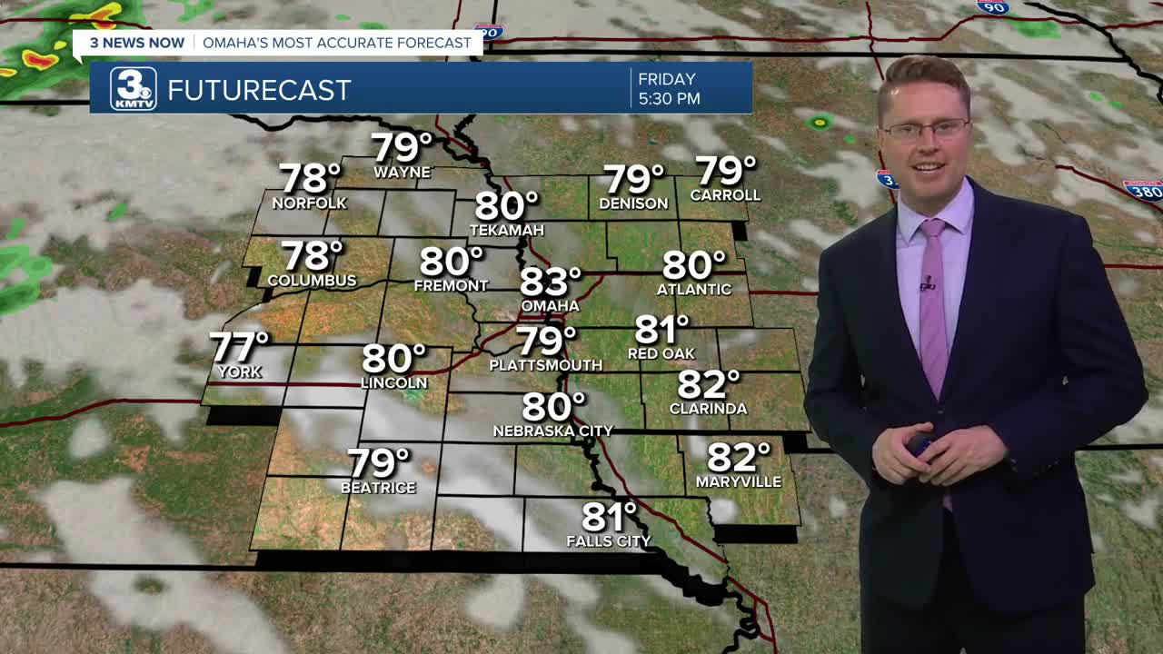
Friday will be a repeat of Thursday with low 80s and partly cloudy skies.
Saturday will be mostly cloudy with a high near 80. Hit and miss rain will start to move into the region from the west in the second half of the day and will continue into the night. Most of the scattered rain will be in eastern Nebraska, but a couple showers could make it into western Iowa.
We will continue to see hit and miss showers on Sunday, but there will be a number of neighborhoods that stay dry all day. Highs will be in the upper 70s with more clouds than sunshine.
While rain isn't as likely Monday for Labor Day, there will still be some spotty showers around. Have an indoor backup plan ready for outdoor plans, just in case. Highs will be in the upper 70s with a lot of clouds.
Tuesday will be partly cloudy as we warm back up to 80 degrees.
A cold front moves in Tuesday night, which could kick off some scattered rain or storms. Depending on the exact timing of the system, some of the rain could continue into early Wednesday.
Wednesday afternoon will bring more sunshine. As cooler air blows in behind the cold front, Omaha will likely only warm into the mid 70s.
THURSDAY
Partly Cloudy
A Little Muggy
High: 83
THURSDAY NIGHT
Partly Cloudy
Comfy
Low: 60
FRIDAY
Partly Cloudy
A Little Muggy
High: 83
SATURDAY
Mostly Cloudy
Hit and Miss Rain
High: 80
Share your weather pictures with KMTV:
- Email to News@3newsnow.com
- 3 News Now Facebook page
- Use the hashtag #3NewsNow on Instagram or X (formerly Twitter)
