

This afternoon will be partly cloudy and a little warmer, but the humidity stays low. Highs will be near 80 in Omaha, but upper 70s will be more common in our neighborhoods north of I-80.
Overnight, we cool off into the upper 50s for Thursday morning. There could be a few foggy areas, but fog will not be a widespread problem.
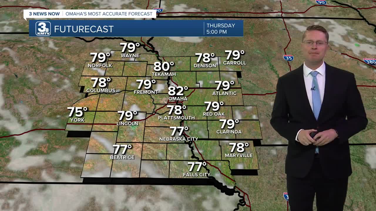
Thursday will be in the low 80s with a little more humidity and a mix of sun and clouds.
We turn mostly cloudy Friday, and we still manage to warm up into the low 80s. A couple isolated showers could pop up over eastern Nebraska and western Iowa, but most of us will be dry.
Saturday will be mostly cloudy with upper 70s. Hit and miss rain will start to move into the region in the second half of the day and will continue into the night. Only about half of our neighborhoods will get hit by the rain.
There will continue to be hit and miss rain around Sunday, but even if you get hit by it, there will be a lot of dry time. Highs will be in the upper 70s again.
While rain isn't as likely Monday for Labor Day, we could easily still have some spotty showers around. Have an indoor backup plan ready for outdoor plans, just in case. Highs will be in the upper 70s.
The chance for rain hitting your backyard Tuesday looks pretty small. Highs will be near 80.
WEDNESDAY
Partly Cloudy
Warmer
High: 80
WEDNESDAY NIGHT
Partly Cloudy
Foggy Areas
Low: 59
THURSDAY
Partly Cloudy
A Little Muggy
High: 82
FRIDAY
Mostly Cloudy
Isolated Showers
High: 81
Share your weather pictures with KMTV:
- Email to News@3newsnow.com
- 3 News Now Facebook page
- Use the hashtag #3NewsNow on Instagram or X (formerly Twitter)
