

3 Things to Know
- Below average temps, but humid this week
- Rain possible Tuesday
- 90º heat could return starting this weekend
Forecast
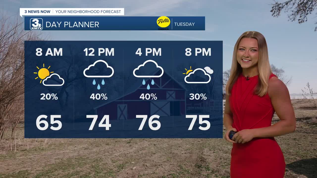
Tuesday will be in the mid to upper 70s with a chance for a few spotty rain showers, or storms after 9 or 10am. Severe weather looks pretty limited, but there may be some lightning, gusty winds and pockets of small hail. Heavy downpours are possible, too. The chance at spotty rain continues into Tuesday evening and comes to an end Tuesday night.
Heading into Wednesday, we'll continue to have cooler than average temps, but there should be some extra sunshine and drier weather, similar to Monday with highs in the upper 70s.
There are more chances at spotty rain and storms Thursday and Friday. It will be mostly cloudy to end the workweek with afternoon temps only in the upper 70s.
By the weekend, some rain is possible on Saturday while it gets breezy and humid with highs in the mid 80s. Sunday will be even hotter, windy and mostly sunny with low 90s for highs.
Be ready for the heat to return. Starting Sunday and continuing through much of next week, afternoon temps will likely be in the low 90s with noticeable humidity. At night, we'll only cool off into the mid 70s. Expect this warmer and mostly rain-free trend to continue into the 4th of July.
TUESDAY
Mostly Cloudy
Spotty Storms
High: 76
Wind: S 5-10
TUESDAY NIGHT
Mostly Cloudy
Light Rain Possible
Low: 63
Wind: S 5-10
WEDNESDAY
Partly Cloudy
Humid
High: 80
Wind: S 5-10
Share your weather pictures with KMTV:
- Email to News@3newsnow.com
- 3 News Now Facebook page
Use the hashtag #3NewsNow on Instagram or X (formerly Twitter)
