

3 THINGS TO KNOW
- Record highs likely on Monday
- Flood Watch until Monday night due to Ice Jam risk
- Getting cooler w/ precip chances later in the week
FORECAST
Tonight, we drop down to the upper 20s with a few clouds overhead.
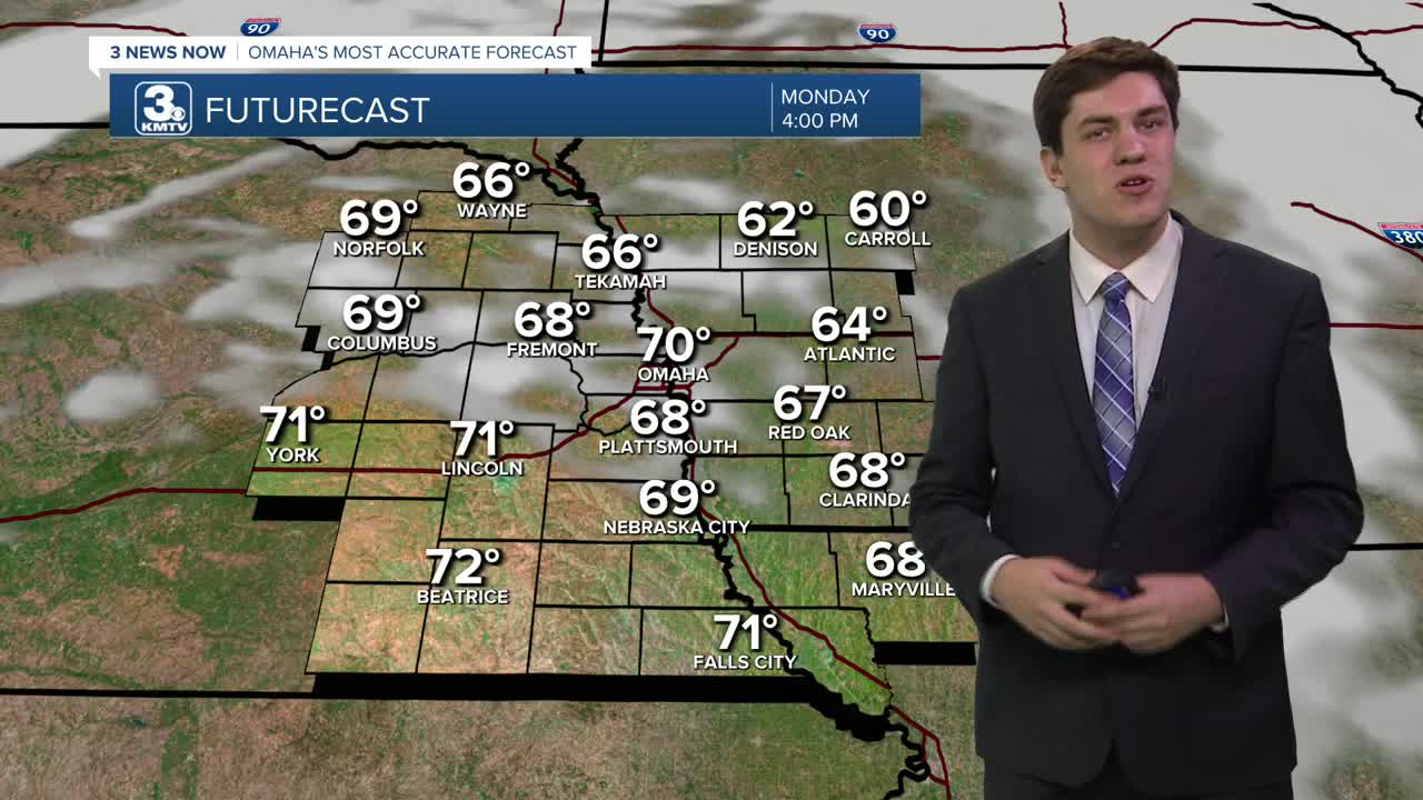
Tomorrow, barring a major change in the forecast, record highs are almost certain to fall in Omaha. The record is 63, set in 1954, and our current forecast for the city is 72! Records in Lincoln & Norfolk (68) are also at risk, as are many in western Iowa.
With the warmth, gusty winds (20-30 mph), and dry fields, there is a high fire risk across eastern Nebraska on Monday afternoon. Avoid any outdoor burning or anything that may start a fire.
With the warm weather, ice movement on the rivers is possible, and a Flood Watch is in effect through Monday evening for this risk. Ice jams can occur with little warning, so anyone with interests along the river should pay attention.
After Monday's warmth, reality settles in for the rest of the week, but we will be above average. Tuesday will have highs in the low 50s under a partly cloudy sky, and Wednesday drops into the upper 40s.
There is a small chance of rain on Thursday, but most of this will stay to our east. With highs in the upper 40s, this is expected to stay all rain.
We have another small chance of rain on Saturday too, but this may stay to our south.
Signals show another warmup by the end of the weekend, with Sunday returning to the mid-50s.
MONDAY
Partly Cloudy
Record Highs
High: 70
Wind: SW 15-25
MONDAY NIGHT
Partly Cloudy
Chilly
Low: 33
Wind: NW 5-15
TUESDAY
Partly Cloudy
Cooler
High: 52
Wind: N 5-15
WEDNESDAY
Partly Cloudy
Above Average
High: 50
Wind: SE 5-10
Share your weather pictures with KMTV:
- Email to News@3newsnow.com
- 3 News Now Facebook page
- Use the hashtag #3NewsNow on Instagram or X (formerly Twitter)
