

3 Things to Know
- Spotty pop ups for Tuesday
- Stormy pattern Thursday and this weekend
- In the 90s after this weekend
Forecast
Our Thursday afternoon continues this pop-up trend, with most storms still located towards the west of Omaha. We'll see temperatures remain a little cooler compared to what we saw yesterday, with highs only reaching the lower 80s.
Wednesday looks mostly dry, with just a small chance at some late-day rain. We should see some sunshine. Highs will reach the mid 80s.
Another round of storms looks to move in Thursday for most of the day, and it may continue into Friday. High temps will be in the mid 80s late in the workweek.
This wet and stormy pattern now looks to continue into the weekend. It won't rain the whole time, but there are decent chances at spotty storms for both Saturday and Sunday with highs in the mid to upper 80s.
After this weekend, it will start to get hot! June averages over eight days in the 90s. We'll begin to see several of those days next week.
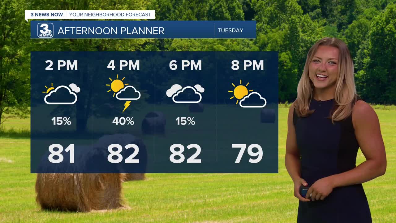
TUESDAY
Mostly Cloudy
Spotty Storms
High: 82
Wind: SE 5-15
TUESDAY NIGHT
Mostly Cloudy
Mild
Low: 62
Wind: SE 5-15
WEDNESDAY
Partly Sunny
Warm
High: 85
Wind: SE 15-25
Share your weather pictures with KMTV:
- Email to News@3newsnow.com
- 3 News Now Facebook page
- Use the hashtag #3NewsNow on Instagram or X (formerly Twitter)
