

3 THINGS TO KNOW
- Final round of severe weather on Monday
- A pleasant week follows the storms
- More rain, not storms, late week
FORECAST
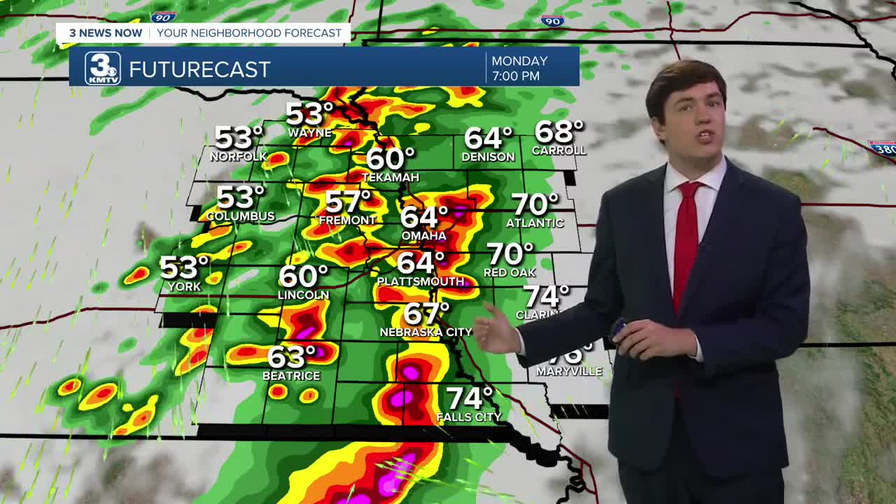
Monday appears to be another significant severe risk as the cold front arrives. Storms develop over SE Nebraska after 2 pm and move northeast. The cold front will be very close to I-80, meaning the tornado risk in the Omaha metro may depend on where the front sets up. If the front is faster, than the tornado threat may stay just southeast of Omaha, but this is too close to call so far. Southeast of town, strong tornadoes are possible with any storms that develop, along with a large hail & damaging wind risk.
After the storms move out Monday night, the rest of next week is pleasant and cool with highs in the 60s. Some rain chance may return, starting on Thursday and Friday.
MONDAY
Partly Cloudy
Severe Storms
High: 76
Wind: SE 5-15
MONDAY NIGHT
Partly Cloudy
Storms End
Low: 47
Wind: SE 5-15
TUESDAY
Partly Cloudy
Cool and Dry
High: 61
Wind: NW 10-25
WEDNESDAY
Partly Cloudy
Cool
High: 62
Wind: CALM
Share your weather pictures with KMTV:
- Email to News@3newsnow.com
- 3 News Now Facebook page
- Use the hashtag #3NewsNow on Instagram or X (formerly Twitter)
