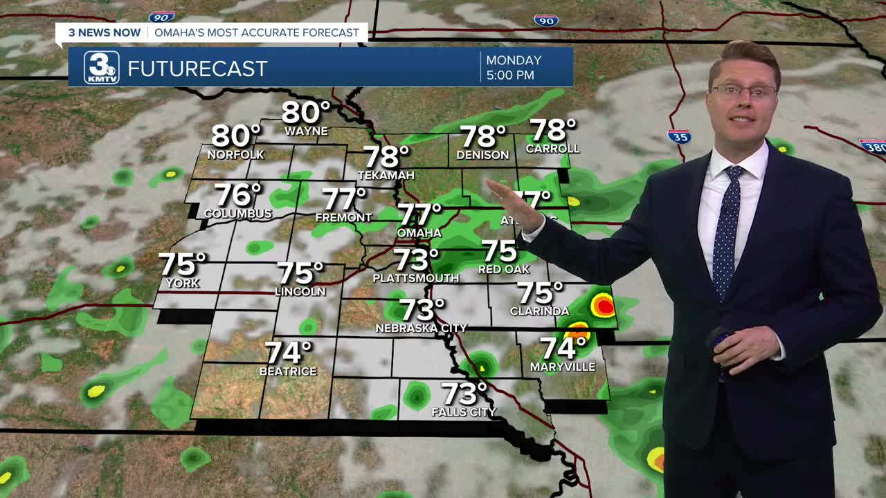


There will continue to be scattered showers and storms the rest of the day, with about 1/2 of our neighborhoods seeing rain by the end of the day. The farther north of Omaha you live, the better your chance is of staying dry. Highs will be in the mid to upper 70s, but wetter areas could be a touch cooler.
There could be a couple isolated showers still around early tonight, but it looks dry overnight. Foggy areas are expected again into Tuesday morning as we cool off into the mid 60s.
We turn mostly sunny for Tuesday afternoon, helping to warm us into the mid 80s. A couple isolated showers are possible south of I-80, but even there, most stay dry.
The Perseid meteor shower peaks Tuesday night. We should have a good view thanks to mostly clear skies. Get away from city lights and look northeast.
Wednesday will be mostly sunny with mid 80s.
It will get a little breezy Thursday as we warm into the upper 80s with a lot of sunshine.
Friday will be hot and humid with low 90s and mostly sunny skies.
We stay in the low 90s Saturday with a lot of sunshine and a lot of humidity. A couple spotty showers and storms could pop up late in the day, but most of eastern Nebraska and western Iowa will be dry.
There's a better chance for some scattered showers and storms Sunday. Highs will be in the upper 80s with a few more clouds.
MONDAY
Mostly Cloudy
Scattered Rain/Storms
High: 81
MONDAY NIGHT
Partly Cloudy
Isolated Rain
Low: 66
TUESDAY
Mostly Sunny
Isolated Rain South
High: 85
WEDNESDAY
Mostly Sunny
Average
High: 86
Share your weather pictures with KMTV:
- Email to News@3newsnow.com
- 3 News Now Facebook page
- Use the hashtag #3NewsNow on Instagram or X (formerly Twitter)
