

After dropping into the 30s this morning, we will enjoy a nice rebound in temperatures this afternoon. Highs will be in the mid 60s with mostly sunny skies. While the wind won't be as strong as yesterday, you may still notice it at times.
We get cold again overnight, dropping into the mid 30s for Thursday morning. This will be cold enough for a few frosty areas to form again.
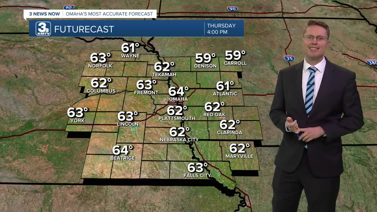
Thursday afternoon will be cool and comfy with mid 60s and a lot of sunshine.
The clouds move back in Friday, dropping us down into the low 60s. There will be a few spotty showers in the region throughout the day, but only about 1/3 of our neighborhoods will see the rain. It will also be a bit breezy at times.
Saturday will be mostly cloudy with low 60s. It stays mostly cloudy Sunday with mid 60s and some extra wind. A few isolated showers will be around the region Saturday and Sunday, but most of us will stay dry both days.
A more organized storm system will move into the Heartland early next week, bringing a better chance for widespread rain. Depending on how quickly it moves, it will get to eastern Nebraska and western Iowa either Monday or Tuesday. Along with the rain, we'll see a little more wind and highs in the upper 50s.
WEDNESDAY
Mostly Sunny
Average
High: 64
WEDNESDAY NIGHT
Mostly Clear
Frost Possible
Low: 36
THURSDAY
Mostly Sunny
Average
High: 64
FRIDAY
Mostly Cloudy
Spotty Rain
High: 62
Share your weather pictures with KMTV:
- Email to News@3newsnow.com
- 3 News Now Facebook page
- Use the hashtag #3NewsNow on Instagram or X (formerly Twitter)
