

After another colder morning, temperatures rebound nicely for the afternoon with the help of mostly sunny skies. Highs will be in the mid 60s.
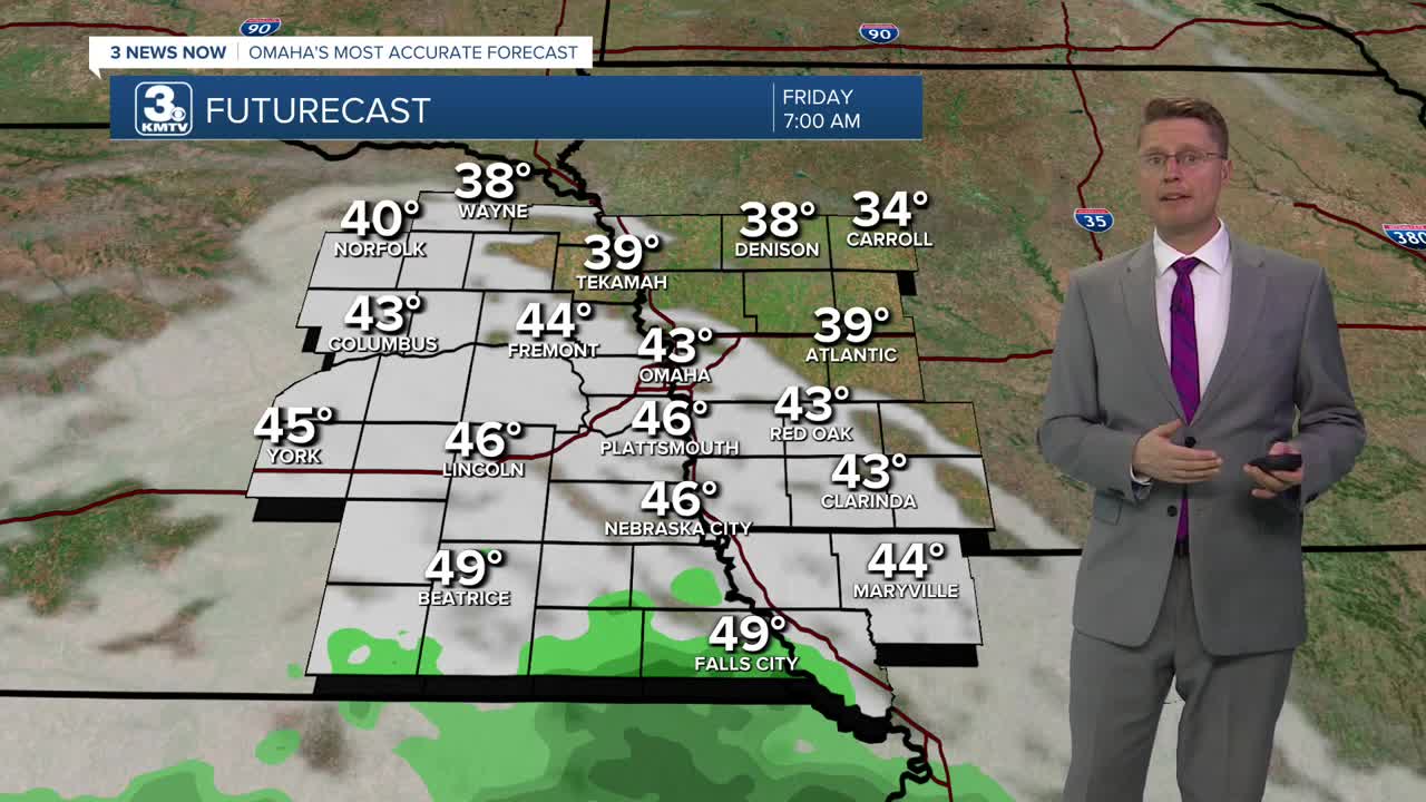
Clouds start to move in overnight, which won't let us cool off as much for Friday morning. We'll start the day in the low 40s.
Throughout Friday, those clouds could squeeze out a few spotty and light showers. There won't be many of them, so most of us stay dry. The slightly better chance of getting hit by one will be south of Omaha. It will also be a little breezy and cooler with upper 50s and low 60s across eastern Nebraska and western Iowa.
Saturday will be mostly cloudy with highs near 60. While there will be a couple isolated showers around, most of our neighborhoods stay dry.
We'll keep the small chance of rain Sunday under mostly cloudy skies. Omaha will be in the low 60s.
Monday will be in the low 60s with mostly cloudy skies.
A more organized weather system will move into the Heartland early next week, bringing a better chance for more of us to see rain. Depending on how quickly it moves, it will get to eastern Nebraska and western Iowa either late Monday or Tuesday.
We drop into the upper 50s behind the rain Tuesday.
The sunshine takes back over Wednesday, but it stays cool with upper 50s.
THURSDAY
Mostly Sunny
Average
High: 64
THURSDAY NIGHT
Partly Cloudy
Not as Cold
Low: 43
FRIDAY
Mostly Cloudy
Spotty Rain
High: 61
SATURDAY
Mostly Cloudy
Isolated Rain
High: 60
Share your weather pictures with KMTV:
- Email to News@3newsnow.com
- 3 News Now Facebook page
- Use the hashtag #3NewsNow on Instagram or X (formerly Twitter)
