

3 THINGS TO KNOW
- Travel issues for the Tuesday AM commute
- Windy Wednesday
- Wet, stormy, and warmer later in the week
FORECAST
The Omaha metro is mostly seeing a sleet/snow mixture, but it's still enough to cause travel issues due to slick roads. Northeast of Omaha, a band of heavy snow is running from Tekamah to Atlantic, causing travel issues over western Iowa. This snow will begin to taper off after 7 am.
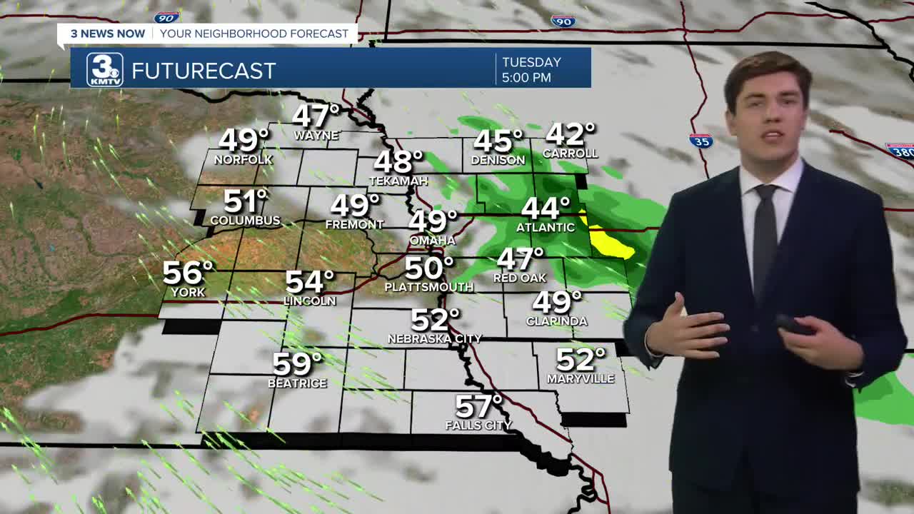
There will just be a few spotty rain showers into the afternoon. Temperatures will be rising through the day, which will begin to melt the snow. Highs by Tuesday evening will be in the 50s for the non-snowy spots, and the low 40s for the ones that saw snow.
We warm Tuesday night into the upper 40s by Wednesday morning, and jump into the 60s/70s by Wednesday afternoon. It will be windy, with gusts up to 45 mph. A mid-afternoon cold front will pop a few thunderstorms toward northwest Missouri, but most of us will be dry. The severe weather risk is very low.
As the front hangs around to the south of Omaha, we could see waves of rain and thunder on Thursday. It won't rain all day, but most of us could see rain at some point on Thursday. The rain moves away on Friday, and it looks dry.
More stormy weather returns for the weekend. A few of these storms could be stronger, particularly on Sunday, depending on how warm we get. Highs are expected to reach the 60s on Saturday and the 70s Sunday.
TUESDAY
Mostly Cloudy
AM Snow Ends
High: 43
Wind: SE 10-25
TUESDAY NIGHT
Mostly Cloudy
Warming
Low: 46
Wind: SE 10-25
WEDNESDAY
Partly Cloudy
Afternoon Storms
Windy
High: 71
Wind: SW 25-45
THURSDAY
Cloudy
Rain & Storms
High: 59
Wind: E 5-10
Share your weather pictures with KMTV:
- Email to News@3newsnow.com
- 3 News Now Facebook page
- Use the hashtag #3NewsNow on Instagram or X (formerly Twitter)
