

3 THINGS TO KNOW
- Cooler than average temps
- Spot storms for Friday
- Warmer this upcoming weekend
FORECAST
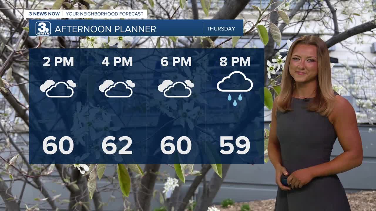
We'll keep with some hefty cloud coverage for most of our Thursday. Once again, our temps are copy-paste, only reaching the lower 60s by this afternoon in most areas. At any given time, we could see some spotty rain into the early evening hours. This would be lighter, lower-impact rain.
The rain becomes a little heavier on Thursday night and Friday. There could at times be some non-severe thunderstorms around Omaha, capable of producing heavier downpours and a couple of rumbles of thunder. Temps will once again only reach the low 60s on Friday.
In total, we could see another 0.25" to 0.75" rainfall. Areas in NW Missouri to SW Iowa could see an inch or more of rain, adding to your already soggy fields.
The rain will clear out late Friday night, and we will start the holiday weekend with partly cloudy skies on Saturday and highs returning to the 70s. Sunday will be even warmer, near 80 degrees!
The warmth will stick around for next week. Memorial Day is on Monday, and it looks mostly sunny with highs in the mid-80s. Omaha will stay in the mid-80s through next week. There are some small chances of rain later into next week, too.
THURSDAY
Mostly Cloudy
Spotty Rain
High: 62
Wind: ESE 10-15
THURSDAY NIGHT
Cloudy
Stormy
Low: 50
Wind: ENE 5-15
FRIDAY
Mostly Cloudy
Scattered Storms
High: 65
Wind: E 15-20
Share your weather pictures with KMTV:
- Email to News@3newsnow.com
- 3 News Now Facebook page
- Use the hashtag #3NewsNow on Instagram or X (formerly Twitter)
