

3 THINGS TO KNOW
- Warmer weather returns next week
- Windy on Tuesday, Wednesday, and Friday
- Rain & snow chances beginning midweek
FORECAST:
It's a cold night tonight with lows dropping into the upper-20s.
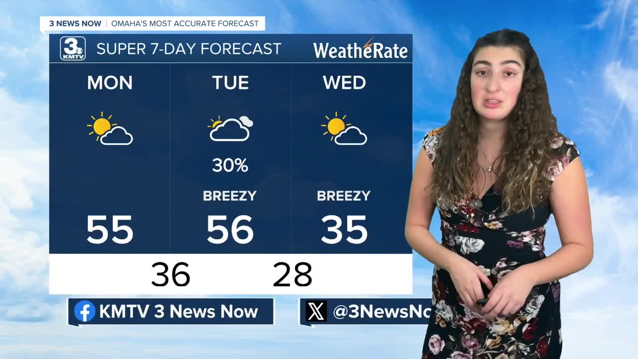
Despite the chilly start, warmer weather returns to start the workweek. Monday will be in the low 50s, and Tuesday into the upper 50s. A few neighborhoods could even reach the 60s again! The record high for Omaha is 63.
A cold front arrives Tuesday evening, kicking up a 25-35 mph wind & ushering in some colder weather for Wednesday. There could be enough moisture for a bit of rain as the front moves through, but most of us will be dry.
Wednesday starts windy & cold, highs will be in the upper 30s.
We are briefly in the 40s on Thursday before another cold front arrives, bringing more wind, cold, and a small snow chance on Friday.
MONDAY
Mostly Sunny
Warmer
High: 53
Wind: SW 5-10
MONDAY NIGHT
Mostly Clear
Chilly
Low: 37
Wind: SW 5-15
TUESDAY
Mostly Cloudy
Warm
High: 58
Wind: W 15-25
WEDNESDAY
Mostly Sunny
Colder
High: 36
Wind: N 15-25
Share your weather pictures with KMTV:
- Email to News@3newsnow.com
- 3 News Now Facebook page
- Use the hashtag #3NewsNow on Instagram or X (formerly Twitter)
