

3 THINGS TO KNOW
- Warmer weather returns next week
- Windy on Tuesday, Wednesday, and Friday
- Rain & snow chances beginning midweek
FORECAST:
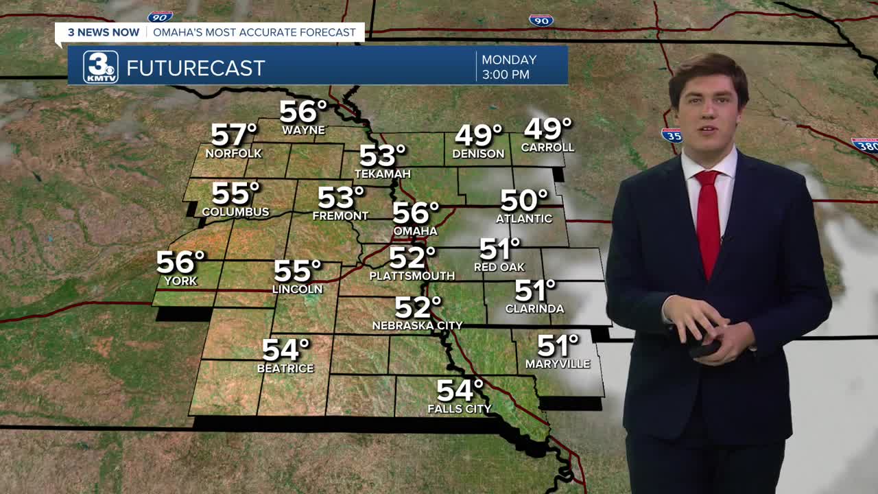
Despite our chilly start, today is going to be mild with highs in the mid-50s.
We get even warmer tomorrow, in the upper 50s. Soak it up, because a cold front in the evening will bring a small chance for rain, alongside 25-35 mph winds.
This cold front will bring colder weather into the region on Wednesday, with highs in the low 30s. This cold weather looks here to stay, with near-to-below average temps lasting through the weekend. Wednesday starts windy, but the wind relaxes through the day.
We briefly reach the 40s on Thursday before a second cold front arrives in the evening. This cold front will bring another chance of snow showers Thursday night into Friday, 30-40 mph winds, and more cold air.
By the weekend, temperatures will drop even further, with Saturday expected to see highs in the low 20s and lows in the 10s.
MONDAY
Mostly Sunny
Warmer
High: 56
Wind: SW 5-10
MONDAY NIGHT
Mostly Clear
Chilly
Low: 36
Wind: SW 5-15
TUESDAY
Mostly Cloudy
Warm & Breezy
High: 58
Wind: W 15-25
WEDNESDAY
Mostly Sunny
Colder & Windy
High: 33
Wind: N 15-25
Share your weather pictures with KMTV:
- Email to News@3newsnow.com
- 3 News Now Facebook page
- Use the hashtag #3NewsNow on Instagram or X (formerly Twitter)
