

The sunshine has taken over for the afternoon, and we stay hot and humid. Highs will be near 90, but it will feel more like 98 late in the day.
Overnight, we will cool off into the upper 60s for Wednesday morning. Fog should not be as widespread, but there could be a few pockets around. An isolated shower could pop up early in the day, but almost everyone will be dry heading into work and school.
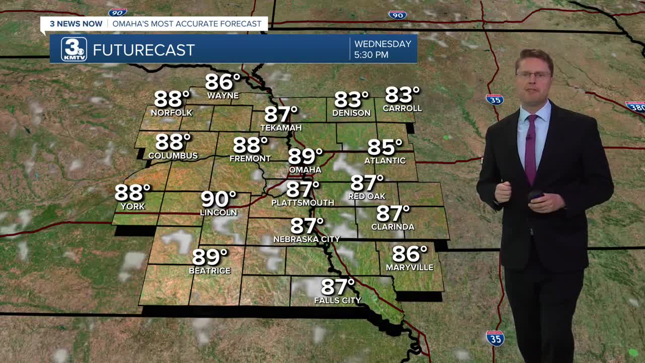
Wednesday afternoon will be mostly sunny with highs just shy of 90. A few hit and miss showers will pop up late in the day, but there won't be many, keeping a lot of our neighborhoods dry.
We stay in the upper 80s Thursday with mostly sunny skies.
A cold front will slowly move southeast through the region Friday. Depending on exactly when it gets here, highs will be around the mid 80s. The cold front will also help kick off some scattered showers and storms, but they won't be for everyone. Right now, it looks like the best chance for rain will be at night.
We spend the weekend dropping the heat and humidity. A leftover shower can't be ruled out Saturday, but it looks like most of us will be dry with a mix of sun and clouds. Highs will be in the low 80s.
Sunday looks great with sunshine and upper 70s.
It stays comfy Monday with mid 70s and mostly sunny skies.
TUESDAY
Mostly Sunny
Humid
High: 90
TUESDAY NIGHT
Mostly Clear
Foggy Areas
Low: 69
WEDNESDAY
Mostly Sunny
Isolated Rain
High: 89
THURSDAY
Mostly Sunny
Muggy
High: 88
Share your weather pictures with KMTV:
- Email to News@3newsnow.com
- 3 News Now Facebook page
- Use the hashtag #3NewsNow on Instagram or X (formerly Twitter)
