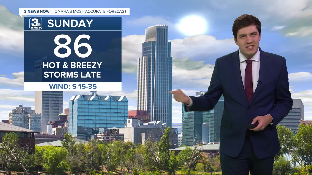


A cold front arrives on Sunday, but not in time to drop the heat by the afternoon. We hit the middle 80s with 30-40 mph winds.
As the cold front passes through, it will spark off showers & storms by the evening (after 8 pm) along and south of I-80. Severe weather is not expected, and not everyone will see rain.
The front is south of us on Monday, but close enough to bring some rain throughout the day. It will not rain all day Monday, but it could rain at any point during the day. Temperatures will be much lower, however. High temperatures on Monday will barely break into the 60s!
The rain move out Tuesday, but the cool weather remains with highs in the upper 60s.
The rest of the week is feeling like fall with highs in the 70s, though we do start to trend warmer by the end of the weekend.
Thursday could bring a chance of showers, but most of us look dry as of now. This is the same on Saturday.
SUNDAY
Partly Cloudy
Breezy
Scattered PM Rain/Storms
High: 86
SUNDAY NIGHT
Mostly Cloudy
Scattered Storms
Low: 56
MONDAY
Mostly Cloudy
Scattered Rain
Much Cooler
High: 60
TUESDAY
Partly Cloudy
Cool
High: 68
Share your weather pictures with KMTV:
- Email to News@3newsnow.com
- 3 News Now Facebook page
- Use the hashtag #3NewsNow on Instagram or X (formerly Twitter)
