

The storms have exited the area, leading to a dry & sunny evening.
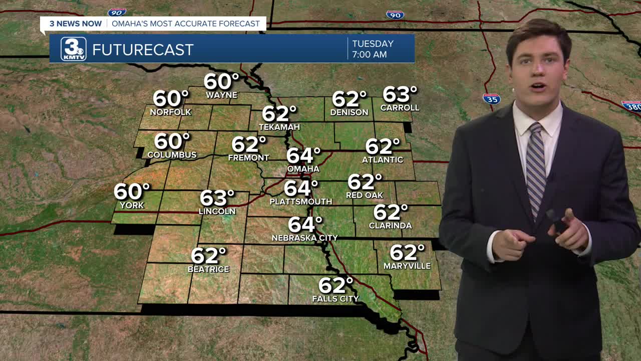
We stay mostly clear overnight, and as the humidity drops, we'll be able to cool off more. This will be your best chance to let some fresh air into your home this week. We will cool off into the upper 50s and low 60s for Tuesday morning.
The humidity stays lower Tuesday afternoon, but it gets a touch warmer. Highs will be in the upper 80s with mostly sunny skies.
It gets a little more muggy again Wednesday with low 90s and a lot of sunshine.
Thursday will be in the low 90s with a few more clouds mixing in with the sunshine. A couple spotty showers and storms are possible late in the day, but most of us will be dry.
The timing of Friday's rain could change, but here's how things look right now. Your 4th of July plans look safest in the morning. It will likely be dry with some good sunshine. In the afternoon, scattered showers and storms will start to pop up, with rain becoming most likely to hit your neighborhood from late afternoon into the evening. We'll begin to dry out into fireworks time, but there will likely still be leftover spotty showers and storms at night. If we stay dry long enough, highs will be in the low 90s.
There could be a few leftover hit and miss storms around Saturday, but a lot more of us will be dry all day. Highs will be near 90 with mostly cloudy skies.
Sunday only brings a slim chance for rain as we cool off into the upper 80s with a mix of sun and clouds.
TUESDAY
Mostly Sunny
Lower Humidity
High: 88
TUESDAY NIGHT
Mostly Clear
Comfy
Low: 66
WEDNESDAY
Mostly Sunny
Hot & Humid
High: 91
THURSDAY
Mostly Sunny
Hot & Humid
High: 93
Share your weather pictures with KMTV:
- Email to News@3newsnow.com
- 3 News Now Facebook page
- Use the hashtag #3NewsNow on Instagram or X (formerly Twitter)
