

3 Things to Know
- Hot & humid weather lasts through Saturday
- Severe storms possible Friday evening (Level: 3/5)
- There are some drier trends now for the 4th of July
Forecast
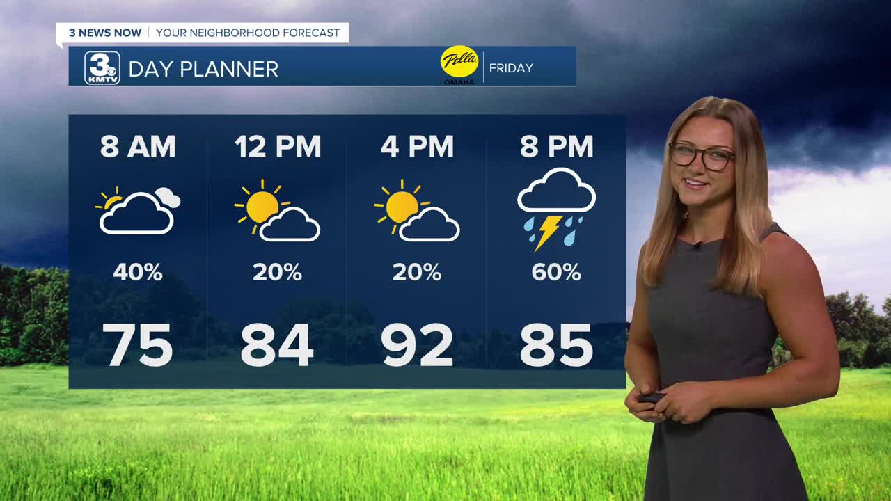
Very similar to our Thursday morning, some of us are waking up Friday to some storms. These storms have traced their way just north of Omaha, exiting into Iowa. These storms don't pose much of a threat at all, and we should see some more sunshine as we near our afternoon.
Friday could be a very hot day, with partly sunny skies and humid conditions. Eventually, the day will end stormy...Highs will be back in the low to mid 90s with heat indices from 100-105. Thunderstorms will be possible after 5-6pm, with some of these storms becoming severe.
The main concern with these Friday evening storms will be damaging winds of 60-75mph and very large hail around 1.50-2.50". The storm activity could become widespread and last for several hours into the overnight, so the risk for flash flooding will become higher as the night goes on.
Eventually, this rain will exit the region either overnight, or early into Saturday morning. In total, we could see upwards of 1.0" to 2.0" of rain in some neighborhoods.
We may still need to be ready to dodge some on on the 4th of July, but the trends are looking drier now for the Omaha region as the expected rain may now stay south into Kansas altogether. There should be enough dry-time and sunshine during the day for temps to reach 90 degrees one more time this week.
By Sunday, things are trending not just drier, but cooler with highs back down into the upper 80s. This slightly milder weather will continue through much of next week.
FRIDAY
Partly Sunny
Hot & Humid
Severe Evening Storms
High: 92
Wind: S 15-25
FRIDAY NIGHT
Windy
Severe Storms
Still Warm
Low: 76
Wind: S 20-25
SATURDAY
Partly Sunny
Hot & Humid
Isolated Storms
High: 90
Wind: S 15-25
Share your weather pictures with KMTV:
- Email to News@3newsnow.com
- 3 News Now Facebook page
Use the hashtag #3NewsNow on Instagram or X (formerly Twitter)
