

3 THINGS TO KNOW
- Thunderstorms linger Thursday morning
- Severe weather possible Friday
- Cooler, drier over Easter weekend
FORECAST
The morning showers that we had are on their way out of the area, leaving behind damp, cloudy conditions. We'll be dry for the remainder of the afternoon and into the evening, highs will reach the 50s.
More rain moves in for Friday, and a few stronger thunderstorms may be possible, too. The area with greatest potential for severe weather will be mainly south and east of Omaha, in southeast Nebraska and southwest Iowa, from 2pm until 7pm. The rest of us will just see more heavy rain that lasts through Friday night.
By Friday night, may rain gauges may show 0.50" to 1.50" in it.
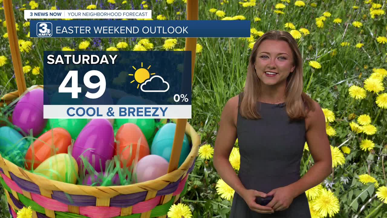
It's now looking like the rain will clear out before the weekend, leaving Saturday drier, but cooler and windy with highs in the upper 40s.
For your Easter Sunday plans, expect a cold morning in the upper 20s, followed by temps in the mid 50s with sunshine and calmer winds in the afternoon.
Temps will stay near average for early April, in the upper 50s for the first few days of next week. There is a chance at rain next Wednesday.
THURSDAY
Mostly Cloudy
Dry Afternoon
High: 55
Wind: E 15-20
THURSDAY NIGHT
Mostly Cloudy
Dry
Low: 38
Wind: N 15-20
FRIDAY
Mostly Cloudy
Afternoon Storms
High: 58
Wind: E 15-20
Share your weather pictures with KMTV:
- Email to News@3newsnow.com
- 3 News Now Facebook page
- Use the hashtag #3NewsNow on Instagram or X (formerly Twitter)
