

3 Things to Know
- Milder and drier Sunday-Tuesday
- Hot with some AM storms Wednesday
- Another round of storms by next weekend
Forecast
It was quite a pleasant day across eastern Nebraska and western Iowa today, with lots of sunshine and highs into the mid-70s! We get cool tonight as temperatures fall into the low 50s.
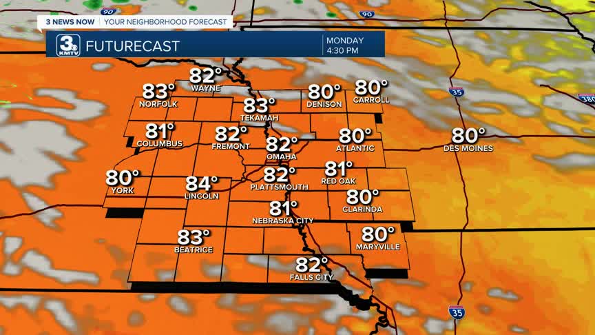
Monday and Tuesday are much of the same, though it's a few degrees warmer, into the low 80s. We may see a few spot showers around Tuesday morning, but most of us will be dry.
Wednesday could be the hottest day of the week, with highs in the upper 80s to low 90s. However, a complicating factor is the potential for thunderstorms, mainly on Wednesday morning. These storms may pose a severe risk, though as of now, the highest severe risk appears to be east of Omaha.
We dry out for Thursday and Friday, and temperatures also fall a bit, back into the 80s.
More storms are possible on Saturday as another storm system takes shape. Temperatures hold in the low 80s.
SUNDAY NIGHT
Clear
Cool
Low: 53
Wind: NW 5-15
MONDAY
Mostly Sunny
Warmer
High: 82
Wind: NW 5-15
TUESDAY
Partly Cloudy
Warm
High: 84
Wind: N 10-15
WEDNESDAY
Partly Cloudy
Morning Storms
High: 89
Wind: NW 15-35
Share your weather pictures with KMTV:
- Email to News@3newsnow.com
- 3 News Now Facebook page
- Use the hashtag #3NewsNow on Instagram or X (formerly Twitter)
