

3 Things to Know
- Hot & humid weather begins Sunday
- Heat lasts through next week
- Midweek storm chances may dampen heat some
Forecast
Low temperatures for Saturday night will be much warmer than Friday, in the mid-70s.
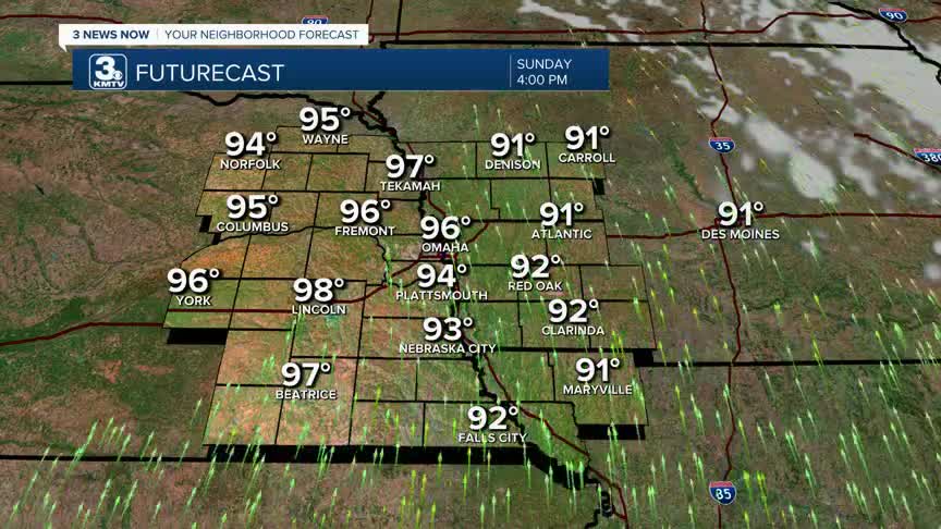
Sunday is the first day of our extended heat episode in the Midwest, with highs reaching the mid-90s. With the high humidity, the heat index could reach 105-110 degrees.
For next week, this pattern will repeat each day with highs in the low-to-mid 90s and lows in the mid-70s.
The heat's danger is not in its intensity, but its duration. A week straight of hot days and warm nights does not allow the body to cool off, especially for those without AC. This adds stress to the body and makes it more susceptible to heat-related illnesses. It's important to remember those heat safety precautions, and to check on our more vulnerable loved ones.
Through next week, clusters of thunderstorms will roam the Midwest. Exactly when and where they will hit is too early to say for specifics, but the best chance of storms could be Tuesday & Wednesday nights. These storms could carry some severe risk, too. Moreover, these may help lower temperatures by a few degrees during the back half of the workweek.
Heading into the holiday weekend, there is no sign of any significant heat relief, so plan on a hot & humid 4th of July. The storm chances look low, but not zero.
SATURDAY NIGHT
Mostly Cloudy
Warm
Low: 75
Wind: SE 5-20
SUNDAY
Mostly Sunny
Hot & Humid
Breezy
High: 96
Wind: S 15-30
MONDAY
Partly Cloudy
Hot & Humid
Windy
High: 96
Wind: S 20-40
TUESDAY
Mostly Cloudy
Overnight Storms
High: 93
Wind: SW 10-25
Share your weather pictures with KMTV:
- Email to News@3newsnow.com
- 3 News Now Facebook page
- Use the hashtag #3NewsNow on Instagram or X (formerly Twitter)
