

3 THINGS TO KNOW
- Snow ends tonight
- Starting the week off cold, but getting warmer
- Rain on Tuesday, then more widespread on Friday
FORECAST
Overnight, some pockets of freezing drizzle may develop south of I-80, but this is a low chance.
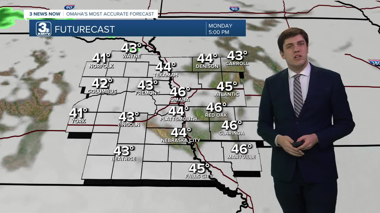
Most of Monday will be dry, but it will stay cloudy with highs in the mid-40s.
Our next storm system moves in Monday night, bringing some rain chances for Tuesday morning. While anyone could see some rain, the best chance will be south of I-80. Highs on Tuesday are a bit warmer, in the upper 40s to low 50s.
The front will be over Kansas and Missouri on Wednesday and Thursday, but it may be close enough for some rain south of I-80. For Omaha, it's looking more probable that Wednesday and Thursday stay dry. However, it does mean that we get warmer with 50s on Wednesday and 60s on Thursday.
A bigger storm system is possible late Thursday into Friday. Widespread rain, along with a few thunderstorms (no severe weather is expected), will move through, particularly in the morning, but may linger into the afternoon. Highs will be in the 60s.
We dry out into the weekend with temperatures in the 50s and 60s.
MONDAY
Mostly Cloudy
Small AM Rain Chance
High: 46
Wind: SE 5-10
MONDAY NIGHT
Mostly Cloudy
Rain Moves In
Low: 34
Wind: SE 5-10
TUESDAY
Cloudy
Scattered AM Rain
High: 50
Wind: NE 5-10
WEDNESDAY
Partly Cloudy
Dry
High: 54
Wind: N 5-10
Share your weather pictures with KMTV:
- Email to News@3newsnow.com
- 3 News Now Facebook page
- Use the hashtag #3NewsNow on Instagram or X (formerly Twitter)
