

3 THINGS TO KNOW
- Drying out for most of Monday
- In the 80s for highs and 60s for lows
- Daily chances of rain/storms, but lots of dry time
FORECAST
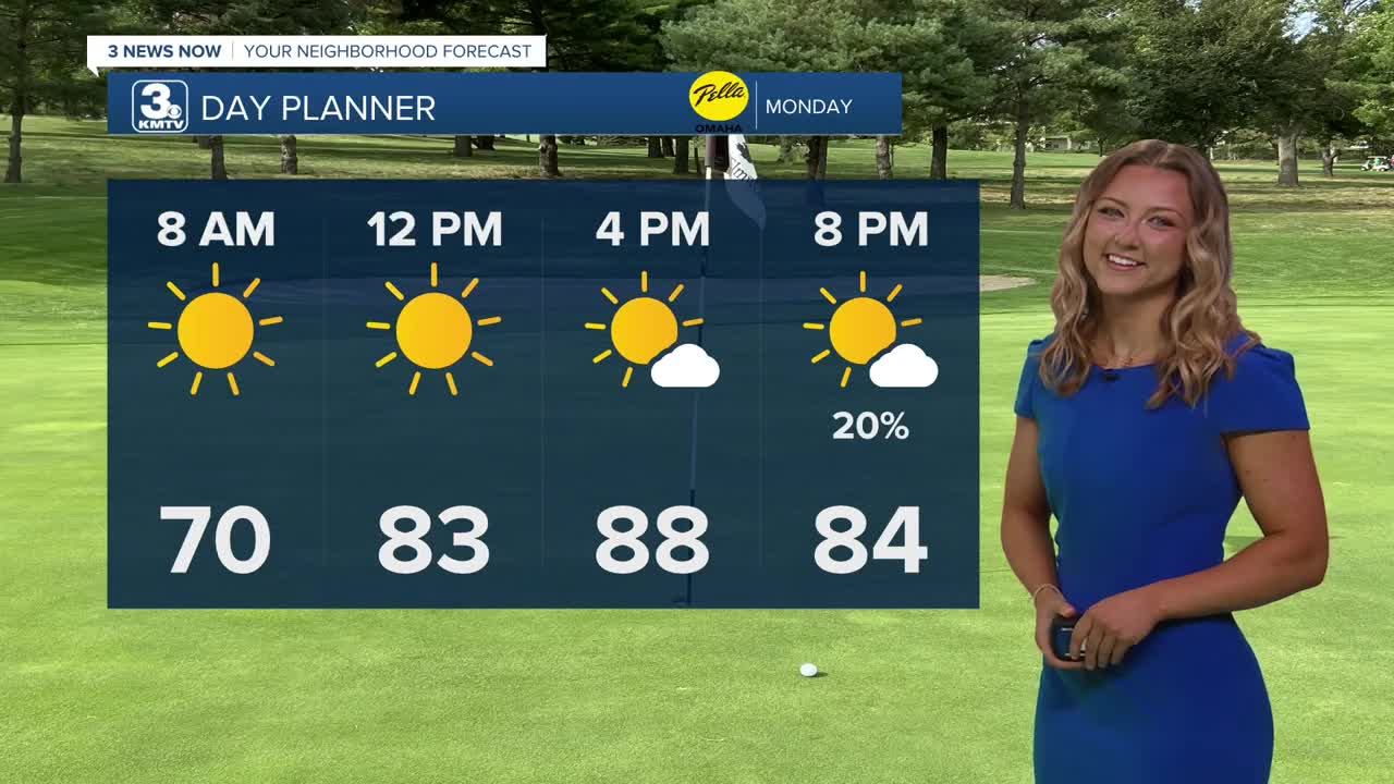
Monday looks to be the driest and warmest of the next few days as highs reach the upper 80s. While a spot storm is possible in the afternoon, most of us will be dry. A few showers may move into eastern Nebraska after midnight, but these should fall apart before they push too far east.
We stay mostly dry for Tuesday, though a few storms may try to develop over central and eastern Nebraska. Highs will reach the low 80s.
Storms may creep a bit closer on Wednesday, but most of them should stay over central Nebraska. Highs on Wednesday will reach the mid-80s.
More widespread storms will arrive on Thursday, beginning a wetter pattern that will lead us into the weekend. This type of pattern will support periodic waves of storms, so timing out when your neighborhood might get rain is difficult this far out. Given the time of year, some of these storms may carry a severe weather threat, too, but it's too early for specifics.
As of now, the best chance for storms looks to be in the afternoon, evening, and night on Thursday and Friday. More afternoon storms are possible into the weekend as well.
Highs will be in the mid-80s throughout.
MONDAY
Mostly Sunny
Warm & Dry
High: 89
Wind: NE 5-10
MONDAY NIGHT
Partly Cloudy
Mild
Low: 65
Wind: SE 5-10
TUESDAY
Partly Cloudy
Mostly Dry
High: 82
Wind: SE 5-15
WEDNESDAY
Mostly Cloudy
Spot Storms West
Breezy
High: 84
Wind: SE 10-25
Share your weather pictures with KMTV:
- Email to News@3newsnow.com
- 3 News Now Facebook page
- Use the hashtag #3NewsNow on Instagram or X (formerly Twitter)
