



3 Things to Know
- Another round of storms on Friday
- Cooler weekend!
- Unsettled weather pattern continues
Forecast
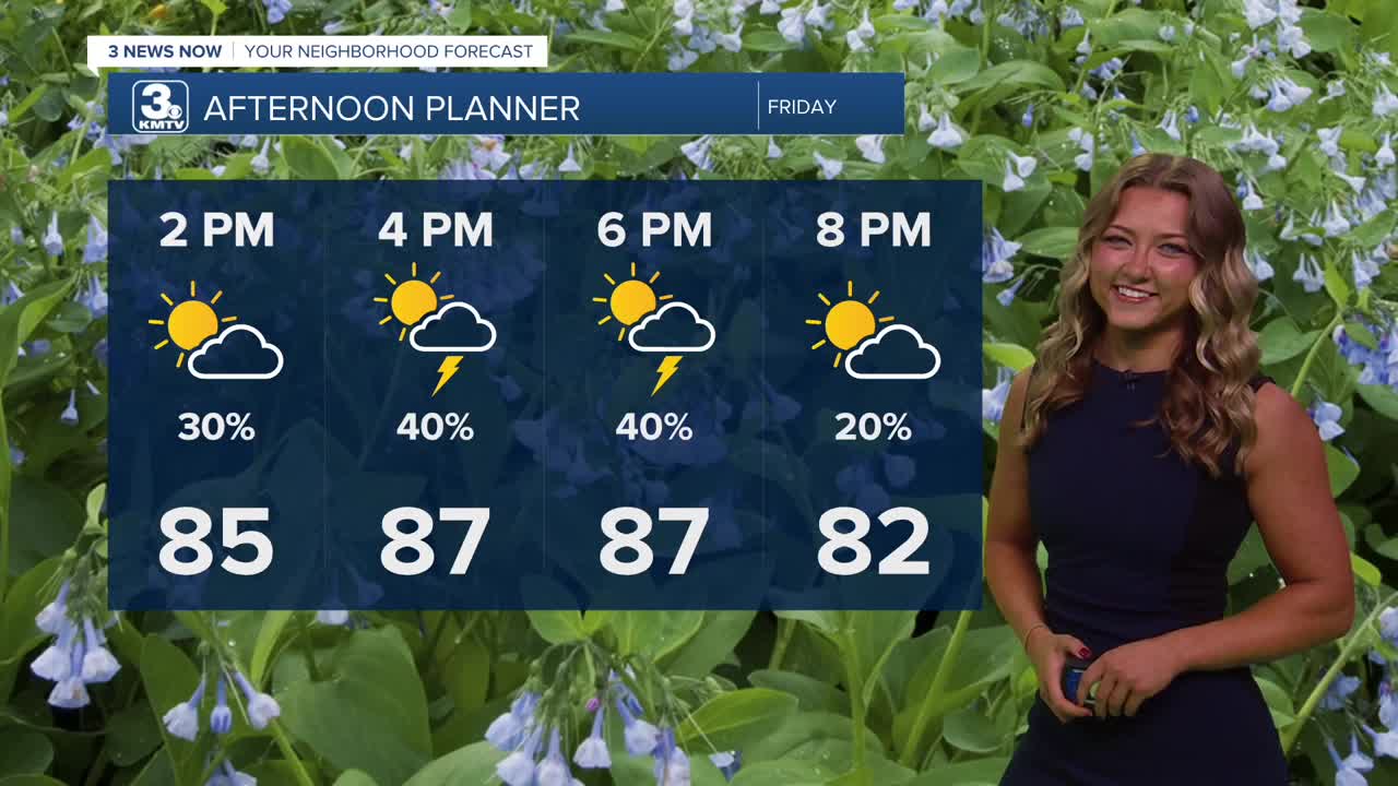
Friday will be a little warmer with highs in the upper 80s. In terms of these afternoon storms, a lot of models have had some unique outputs! For the most part, these storms are trending to bubble up in central Nebraska during the early aftenoon hours, then make their way farther SE. That means areas like Beatrice, York, and possibly even Lincoln could be in the path of these severe storms. Most models have shown Omaha avoiding majority of the rainfall, but it's a good idea to remain aware with weather alerts nonetheless this Friday!
Overnight, models are forecasting some heavier rain near central Nebraska. Similar to what we see for this afternoon, that second round of heavier rainfall will likely track towards the SE, adding to amounts recieved closer to the southern border of the state.
This weekend looks great on Saturday! We'll see lots of sunshine with temps in the mid-80s, though quick pop up storm is possible.
Clouds will return Sunday, and there may be a few rain showers around, mainly west of Omaha. More storms appear possible Sunday night as they push east, and last into Monday afternoon.
Looking ahead towards next week, it looks like we'll see some more spotty rain chances. Temps will remain right around that average high, expect the mid 80s.
FRIDAY
Partly Sunny
Spotty Storms
High: 88
Wind: S to NW 5-15
FRIDAY NIGHT
Some Heavy Rainfall
Cooling
Low: 66
Wind: S 5-10
SATURDAY
Mostly Sunny
Mostly Dry
High: 84
Wind: N 5-10
SUNDAY
Mostly Sunny
Scattered Rain West
High: 80
Wind: SE 5-10
Share your weather pictures with KMTV:
- Email to News@3newsnow.com
- 3 News Now Facebook page
- Use the hashtag #3NewsNow on Instagram or X (formerly Twitter)
