

WHAT TO KNOW:
- Windy and colder on Wednesday
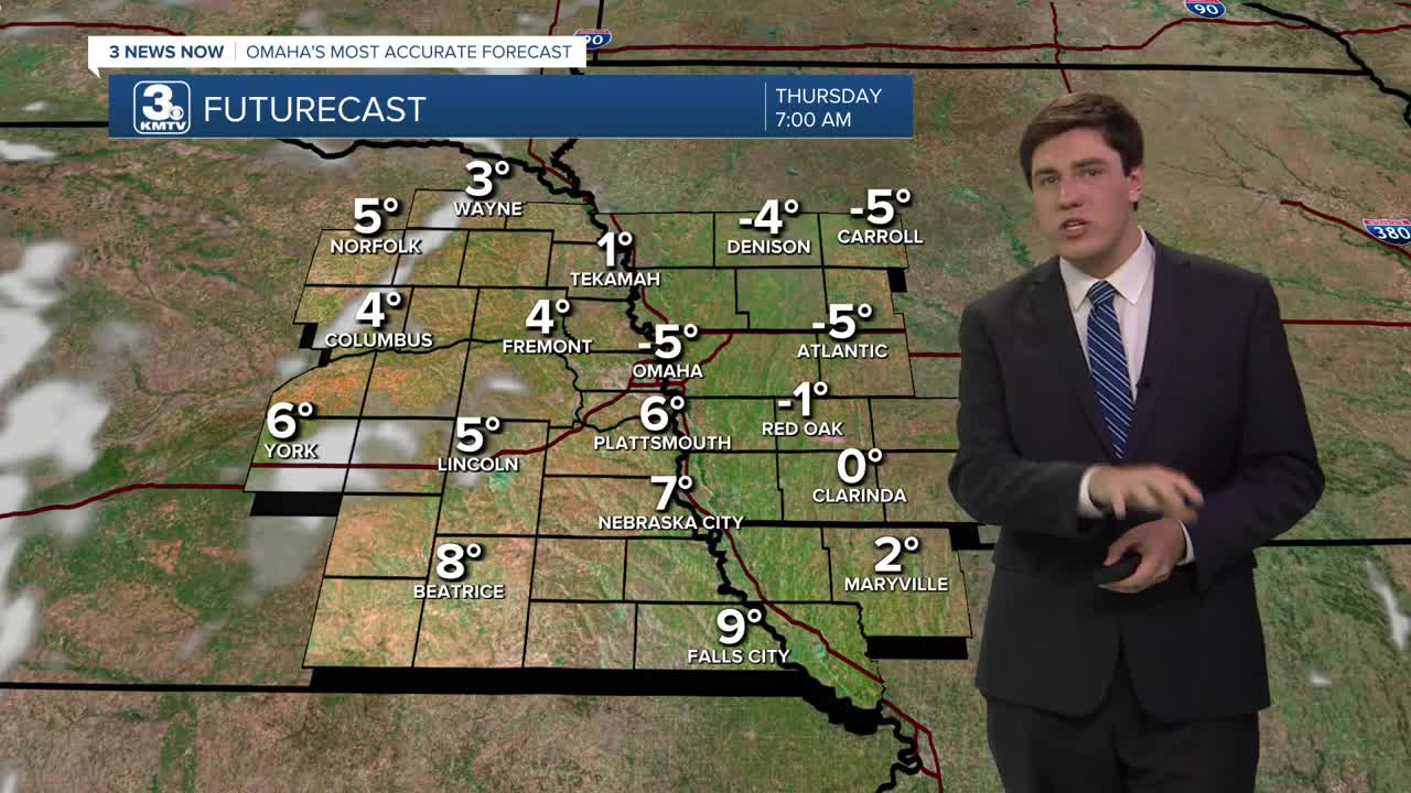
- BRISK Thursday morning, below zero
- More light snow on Saturday
FORECAST:
A strong cold front on Wednesday morning will bring windy conditions, snow flurries, and cause the temperatures to be "flipped", meaning we are the warmest in the morning and colder throughout the day. As you head out to work or school, it will be in the low 30s. As you head home, it will have dropped into the upper 10s.
There is a small chance for a wintry mix during the morning, so be cautious for slick spots while driving.
We bottom out on Wednesday night with lows around -5 degrees. This will be the first time this season we will drop below zero. The wind should quickly calm on Wednesday night, so Thursday morning's wind chill will only be down around -15 to -10.
Thursday will be sunny, but cold, with highs in the lower 20s. We'll hold in the 10s for Thursday night.
We slowly climb out of the bitter cold by the end of the week and into the weekend, with low-to-mid 30s on Friday and Saturday.
Another storm system could impact the region with light snow on Saturday, possibly mixing with rain. At this time, it doesn't look as impactful as the winter storm we had this past weekend, but some small snow accumulation may be possible heading into Saturday evening.
By Sunday, it will be partly sunny and cooler, in the mid-20s.
Next week is trending toward being at or above average, with highs in the 30s and 40s.
WEDNESDAY
AM Clouds/PM Sun
AM Wintry Mix
Falling Temps
Breezy
8 AM Temp: 30
4 PM Temp: 19
Wind: NW 25-35
WEDNESDAY NIGHT
Mostly Cloudy
Very Cold
Low: -5
Wind: N 5-15
THURSDAY
Mostly Sunny
Cold
High: 21
Wind: NE 5-10
FRIDAY
Mostly Sunny
Not as Cold
High: 34
Wind: SW 5-10
Share your weather pictures with KMTV:
- Email to News@3newsnow.com
- 3 News Now Facebook page
- Use the hashtag #3NewsNow on Instagram or X (formerly Twitter)
