

3 THINGS TO KNOW
- Temps to hover below average highs
- Next rain chance comes Thursday/Friday
- Warmer this upcoming weekend
FORECAST
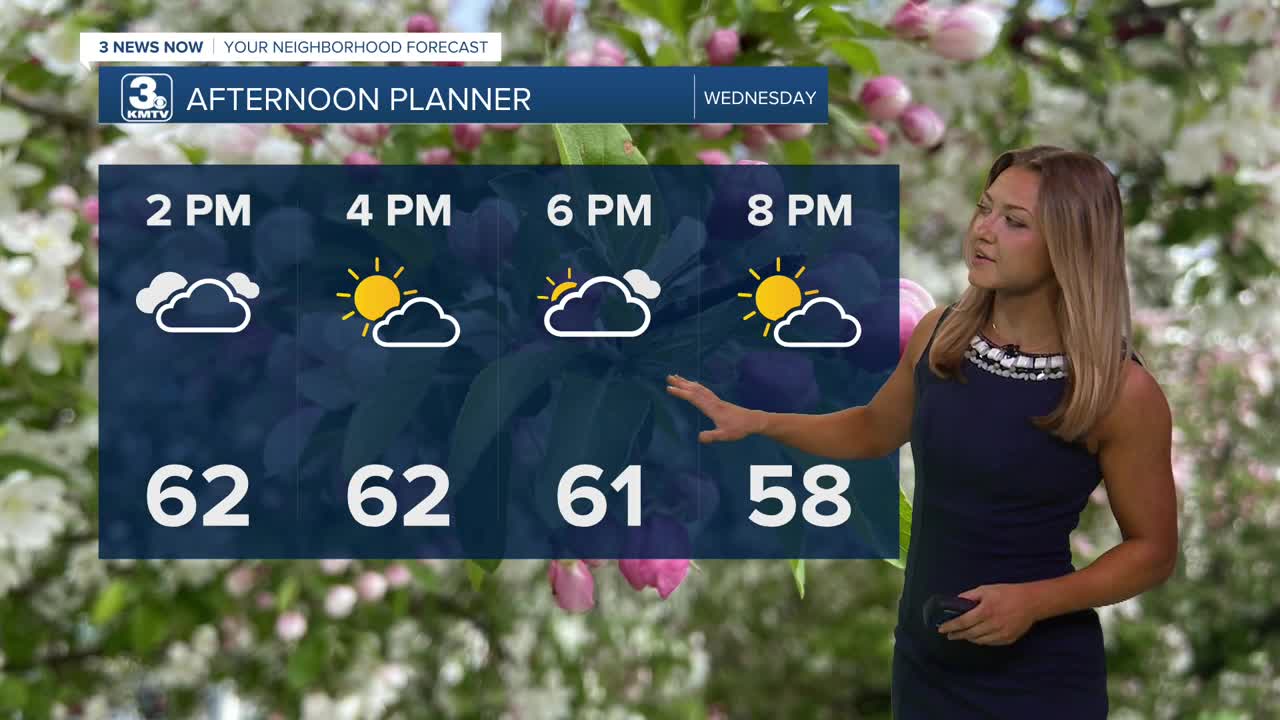
Clouds will build as we head into our afternoon, keeping high temps below average once again. It'll actually be copy-paste with our temps for a while, with the next few days only tapping out around the low 60s.
Rain returns to the region Thursday and Friday, and we could see another 0.25" to 0.75" rainfall. Areas in NW Missouri to SW Iowa could see an inch of rain, adding to your already soggy farm fields. Thursday will likely have quite a bit of dry-time, but Friday is now looking likely a pretty wet day with a few non-severe thunderstorms mixing in. This rain should clear out by Saturday morning.
The upcoming Memorial Day weekend looks sunnier, warmer with temperatures climbing back into the 70s by Saturday and 80s by Sunday. Monday is Memorial Day and it looks sunny with highs in the mid 80s, and we'll keep with the warmth as we head into the start of next week!
WEDNESDAY
Partly Cloudy
Cool
High: 62
Wind: ENE 5-15
WEDNESDAY NIGHT
Few Spotty Showers
Cloudy
Low: 46
Wind: ENE 5-15
THURSDAY
Mostly Cloudy
Isolated Rain
High: 62
Wind: ESE 10-15
Share your weather pictures with KMTV:
- Email to News@3newsnow.com
- 3 News Now Facebook page
- Use the hashtag #3NewsNow on Instagram or X (formerly Twitter)
