

3 THINGS TO KNOW
- Late, light snow/rain mix tonight
- Temps to drop by the weekend
- Damaging wind and snow possible Sunday
FORECAST
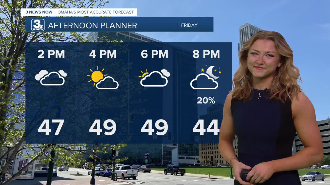
Majority of the wind has subsided by this afternoon, and temperatures seem to be crawling to about the upper 40s with some sunshine!
A weak system moves through the region late Friday night, and could bring a quick dusting of rain/snow mix before Saturday morning. Any snow amounts will be a dusting or less.
It will be a cloudy weekend, and starts with high 50s on Saturday
Sunday will be a very active weather day for Omaha, and damaging winds are possible in addition to snow.
Wind gusts will likely be around 55-65 mph, and a rain to snow mix which could bring a few inches of snow accumulation. For now, amounts likely stay under 4" for most. Near-blizzard conditions are possible during the day due to the high wind and low visibility. With winds exceeding 60mph, tree and property damage, including power outages are possible Sunday.
Temperatures will go from the 30s on Sunday to near 10 degrees by Monday morning.
It will be a very cold start to next week, with highs in the 20s on Monday, returning to near 40 by Tuesday. By the end of the week, we are pushing 80 degrees.
FRIDAY
Partly Cloudy
Not As Windy
High: 50
Wind: NW 15-25
FRIDAY NIGHT
Partly Cloudy
Light Rain/ Snow Mix
Low: 32
Wind: NW 10-15
SATURDAY
Mostly Cloudy
Warmer
High: 59
Wind: ESE15-25
Share your weather pictures with KMTV:
- Email to News@3newsnow.com
- 3 News Now Facebook page
- Use the hashtag #3NewsNow on Instagram or X (formerly Twitter)
