

3 THINGS TO KNOW
- Storms with pockets of hail Thursday
- Drier on Friday
- Several rounds of storms this weekend
FORECAST
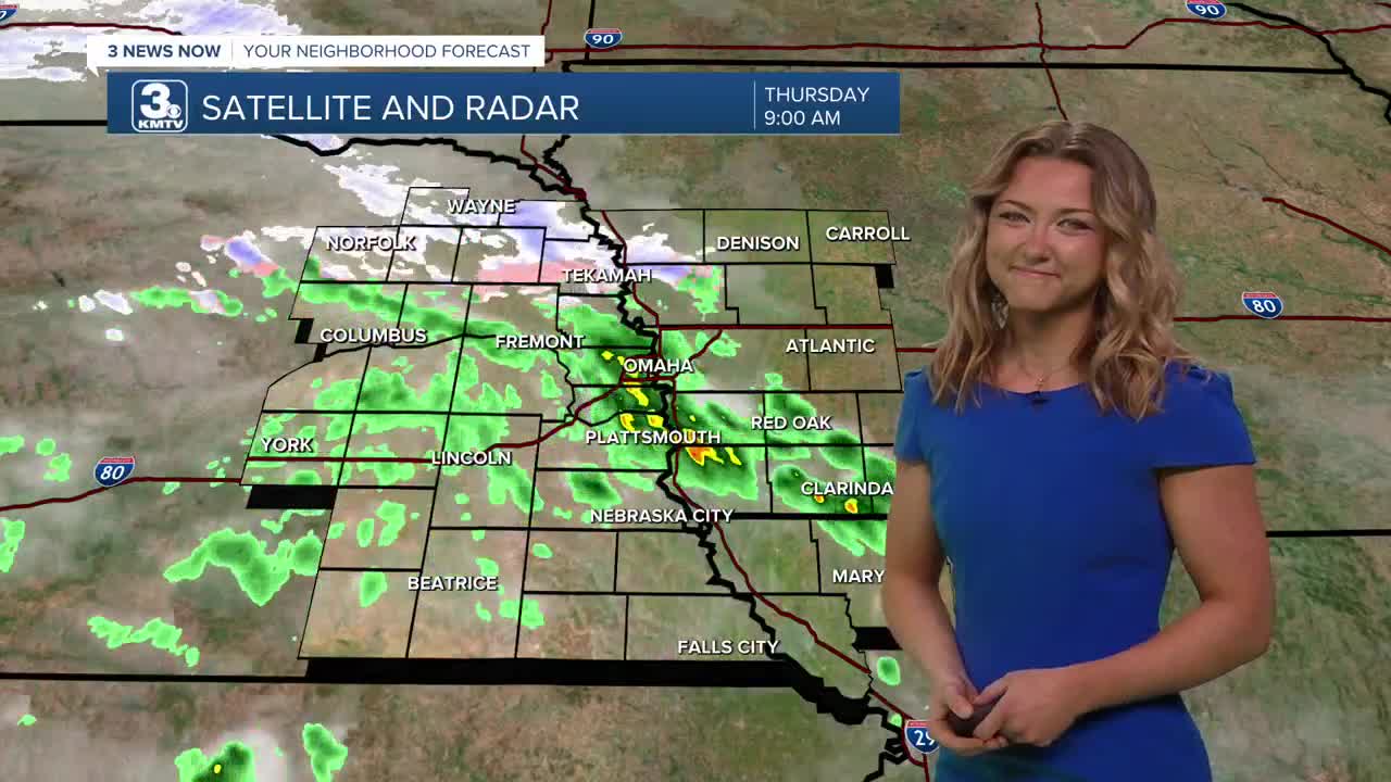
Storms have already begun across most of the area this Thursday, with some of us even seeing some pea sized hail this morning.
The greater severity risk will occur this afternoon into evening. My main area of concern lies within those near the Southeastern border of Nebraska and parts of Northwestern Missouri. Hail remains the greatest threat, and we can't rule out the possibility of some gusty winds.
This rain will slowly exit the region Thursday night, leaving Friday drier and partly sunny with highs near 60.
More stormy weather returns for the weekend, with off and on rounds of storms Saturday morning through Sunday evening. A few of these storms could be strong to severe with all types of weather possible, mainly on Sunday. It will be breezy with weekend and highs are expected to reach the 60s on Saturday and the 70s Sunday.
Estimated rainfall amounts will be around 0.50" to 1.00" through Sunday night.
It stays warmer than average, in the 80s on Monday, followed by another round of storms on Tuesday, cooling things off into the 60s for the middle of next week.
THURSDAY
Cloudy
Rain & Storms
High: 61
Wind: E 10-15
THURSDAY NIGHT
Stormy
Hail Possible
Low: 41
Wind: E 10-15
FRIDAY
Partly Sunny
Drier
High: 60
Wind: NE 10-15
Share your weather pictures with KMTV:
- Email to News@3newsnow.com
- 3 News Now Facebook page
- Use the hashtag #3NewsNow on Instagram or X (formerly Twitter)
