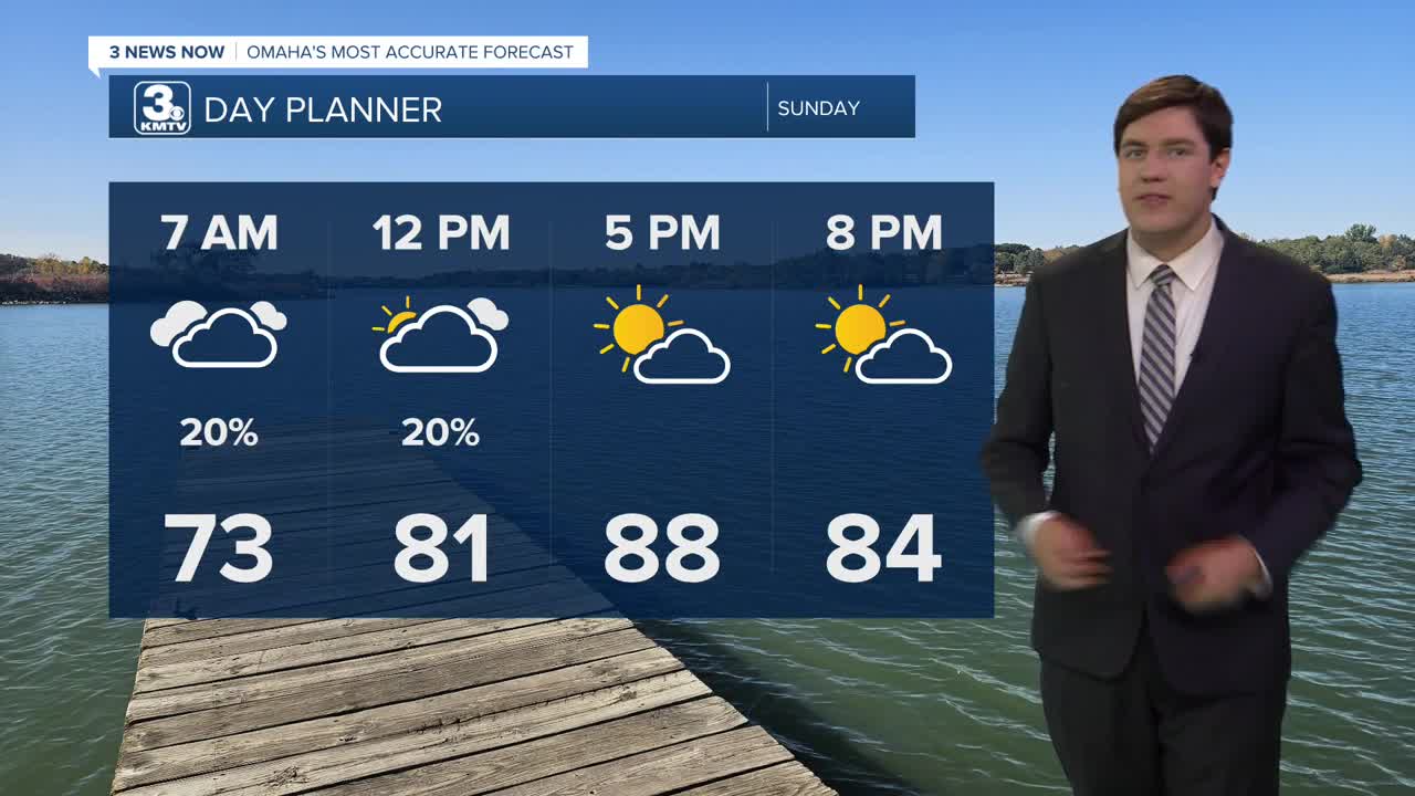


Any storms that do come through overnight are gone by Sunday morning, and we wake up in the low 70s. It's a hot day on Sunday with highs reaching the upper 80s. A spot storm is possible Sunday evening into the overnight, but many stay dry.
Monday begins the first day of our heat wave as highs reach the low 90s. With the humidity, heat index values could be as high as 100 during the day. Monday evening could come with a spot storm, but most will be dry.
Tuesday and Wednesday are the peak of the heat with highs in the upper 90s with heat index values as high as 105-110. This is dangerous heat for those being outdoors for an extended period. Remember those heat safety precautions, and check in on those vulnerable to the heat this week.
With overnight lows in the middle 70s, it won't offer much relief from the heat.
Our temperatures lower a tad by late week, low 90s, but heat index values will still be close to 100. We also re-introduce storm chances Thursday night and again Friday night.
Low 90s continue into the weekend and beyond.
SUNDAY
Partly Cloudy
Spotty Storms
Muggy
High: 88
SUNDAY NIGHT
Partly Cloudy
Spotty Storms
Low: 72
MONDAY
Partly Cloudy
Hot & Humid
High: 93
TUESDAY
Mostly Sunny
Hot & Humid
High: 97
Share your weather pictures with KMTV:
- Email to News@3newsnow.com
- 3 News Now Facebook page
- Use the hashtag #3NewsNow on Instagram or X (formerly Twitter)
