

3 THINGS TO KNOW
- Temps gradually incline through the weekend
- Rain chances Saturday morning
- Record threatening highs early next week
FORECAST
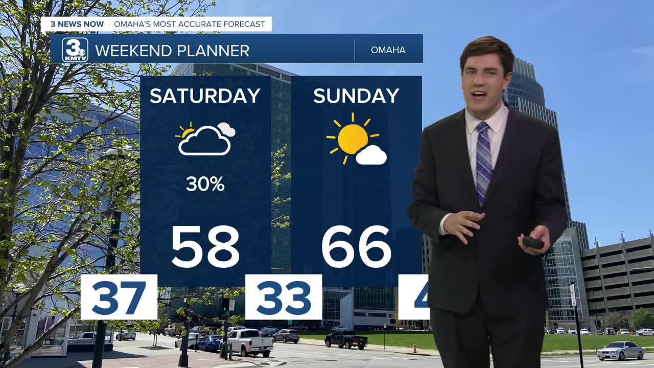
While most of us will stay dry on Valentine's Day, a storm system may bring some rain to neighborhoods south of I-80. It's not expected to be a washout, but check the radar before heading outdoors. In Omaha, odds are the city remains dry.
With the sunshine returning on Sunday, we get even warmer with highs cresting the mid-60s.
Monday's record is at risk with the forecast high of 67, which ties the record set in 2017. Tuesday keeps the upper 60s and even 70s going.
The first of a couple of storm systems passes by Tuesday evening, bringing a rain shower or two, though most will be dry.
Wednesday stays warm, in the low 60s.
A second, bigger system may impact us on Thursday with another small rain chance. What may be more impactful, however, is an end to the well-above-average weather by late next week.
SATURDAY
Mostly Cloudy
Rain Chance South
High: 58
Wind: SE 5-10
SATURDAY NIGHT
Partly Cloudy
Not As Cold
Low: 33
Wind: SE 5-10
SUNDAY
Mostly Sunny
Warm
High: 66
Wind: S 5-10
MONDAY
Mostly Sunny
Warm
High: 67
Wind: S 5-10
Share your weather pictures with KMTV:
- Email to News@3newsnow.com
- 3 News Now Facebook page
- Use the hashtag #3NewsNow on Instagram or X (formerly Twitter)
