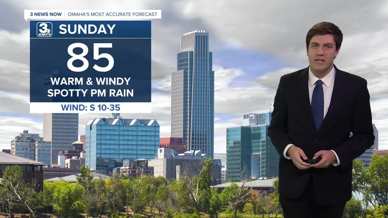


Sunday will be warm and windy ahead of a cold front, with highs reaching the middle 80s. By the evening, a few showers may develop over us, but many of us will stay dry.
The cold front ushers in cooler weather on Monday, with highs only topping out in the upper 60s. Monday looks mostly dry, too.
Another cold front arrives on Tuesday, which could bring some rain in the afternoon. It's also the coolest day of the week, with highs in the lower 60s.
Small rain chances continue into Wednesday as we climb back into the 70s.
Another cold front arrives Thursday with some extra wind, but it's warm beforehand as highs reach the upper 70s. Showers and storms are possible beginning Thursday night, but many of us look dry as of now.
We drop into the lower 70s and keep it dry by next weekend.
SUNDAY
Partly Cloudy
Isolated PM Rain
Windy
High: 85
SUNDAY NIGHT
Mostly Cloudy
Isolated Rain
Low: 54
MONDAY
Partly Cloudy
Cooler
High: 69
TUESDAY
Mostly Cloudy
Afternoon Rain
High: 63
Share your weather pictures with KMTV:
- Email to News@3newsnow.com
- 3 News Now Facebook page
- Use the hashtag #3NewsNow on Instagram or X (formerly Twitter)
