

3 THINGS TO KNOW:
- Near 60 and breezy Monday
- Clouds may keep us cooler on the holiday
- Mostly dry until after this weekend
FORECAST:
Christmas week is looking not just warmer than average for this time of December, when the average highs are now around 36 degrees, but near some of our record highs!
Records
Monday : 63 (1933)
Tuesday: 67 (1964)
Wednesday: 68 (1889)
Thursday: 57 (1946)
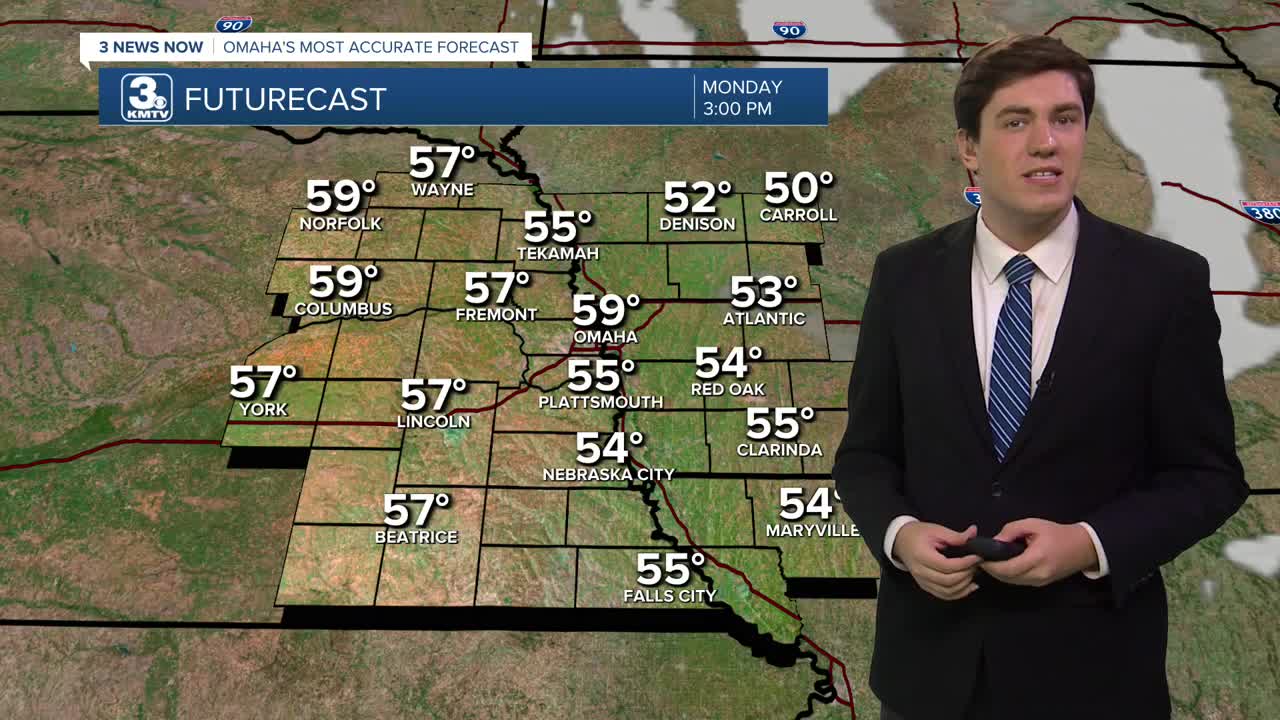
The true warmth starts today, with all of us reaching the mid-50s. A few neighborhoods in eastern Nebraska may go above & beyond and hit the 60s this afternoon! Omaha likely falls just shy of this, however.
A "cold front" will shave a few degrees off the high temp for Tuesday (mid-50s), but it's still well above average. Clouds begin to build in by the afternoon.
Low clouds move in on Wednesday morning. These may hang around through Christmas Eve into Christmas Day. Occasionally, some fog or drizzle may accompany the clouds, but most of us will stay dry.
The bigger impact will be on temperatures, as the clouds may keep us from achieving our maximum warmth. While it will still be warm, highs on Christmas Eve may reach the low 50s, and the mid-50s on Christmas Day.
We have one more day in the 50s on Friday before a cold front brings us back to reality for the weekend. While Saturday's cold front will struggle to bring any rain, it will kick up the wind as colder air blows in.
We drop into the 40s on Saturday and the 30s on Sunday.
MONDAY
Mostly Sunny
Warm & Breezy
High: 59
Wind: S 15-25
MONDAY NIGHT
Partly Cloudy
Getting Cooler
Low: 34
Wind: NW 5-10
TUESDAY
Partly Sunny
Slightly Cooler
High: 54
Wind: N 5-10
WEDNESDAY
Cloudy
Foggy & Drizzle
High: 50
Wind: S 5-10
Share your weather pictures with KMTV:
- Email to News@3newsnow.com
- 3 News Now Facebook page
- Use the hashtag #3NewsNow on Instagram or X (formerly Twitter)
