

3 Things to Know
- Hot & humid weather continues
- Storms with damaging wind over the next few nights
- Might be a rainy and hot July 4th weekend
Forecast
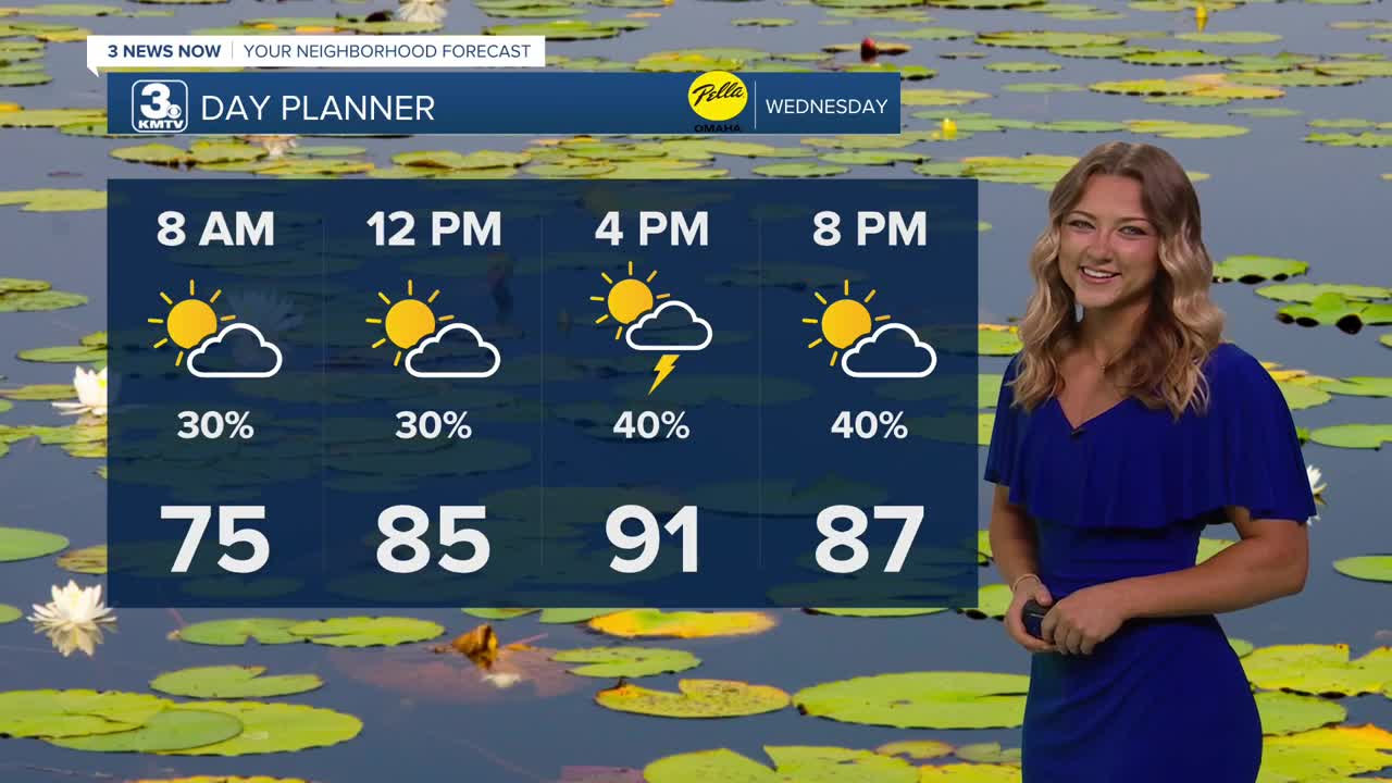
Our Wednesday morning is once again warm, with temps already in the lower 80s! We'll keep with the clouds for most of our morning, and even as we head into the afternoon.
Rain and isolated storms will be possible at any point of the day on Wednesday. Overall, the rain will be hit-and-miss. It remains warm and humid with breezy south winds and highs in the low 90s, a few degrees cooler than earlier in the week thanks to the cloud cover and very spotty rain. Scattered storms will be possible Wednesday night.
This scattered stormy pattern will continue through Thursday with partly sunny skies, breezy winds and highs closer to 90 degrees, feeling like 100. Spotty storms will be possible Thursday night.
It gets very hot again Friday, but it will probably be our last really hot and humid day where heat indices could top 105-110 again. Look for highs in the mid 90s. Once again, storms will be possible Friday night after 8-10pm.
For your 4th of July plans, there could be rain at any point in the day on Saturday, but the best times to see storms will be after 5-6pm. Before the rain and storms hit later in the day, we should be dry and sunny enough to reach the low 90s.
By Sunday, things are trending not just drier, but cooler with highs back down into the upper 80s. This slightly cooler weather will continue through much of next week.
WEDNESDAY
Partly Cloudy
Spotty Storms
High: 92
Wind: S 15-25
WEDNESDAY NIGHT
Isolated Storms
Still Warm
Low: 74
Wind: S 15-25
Share your weather pictures with KMTV:
- Email to News@3newsnow.com
- 3 News Now Facebook page
- Use the hashtag #3NewsNow on Instagram or X (formerly Twitter)
