



3 Things to Know
- A hot Wednesday with evening storms possible
- Rainy & milder Thursday
- Several 90º to 95º+ days next week
Forecast
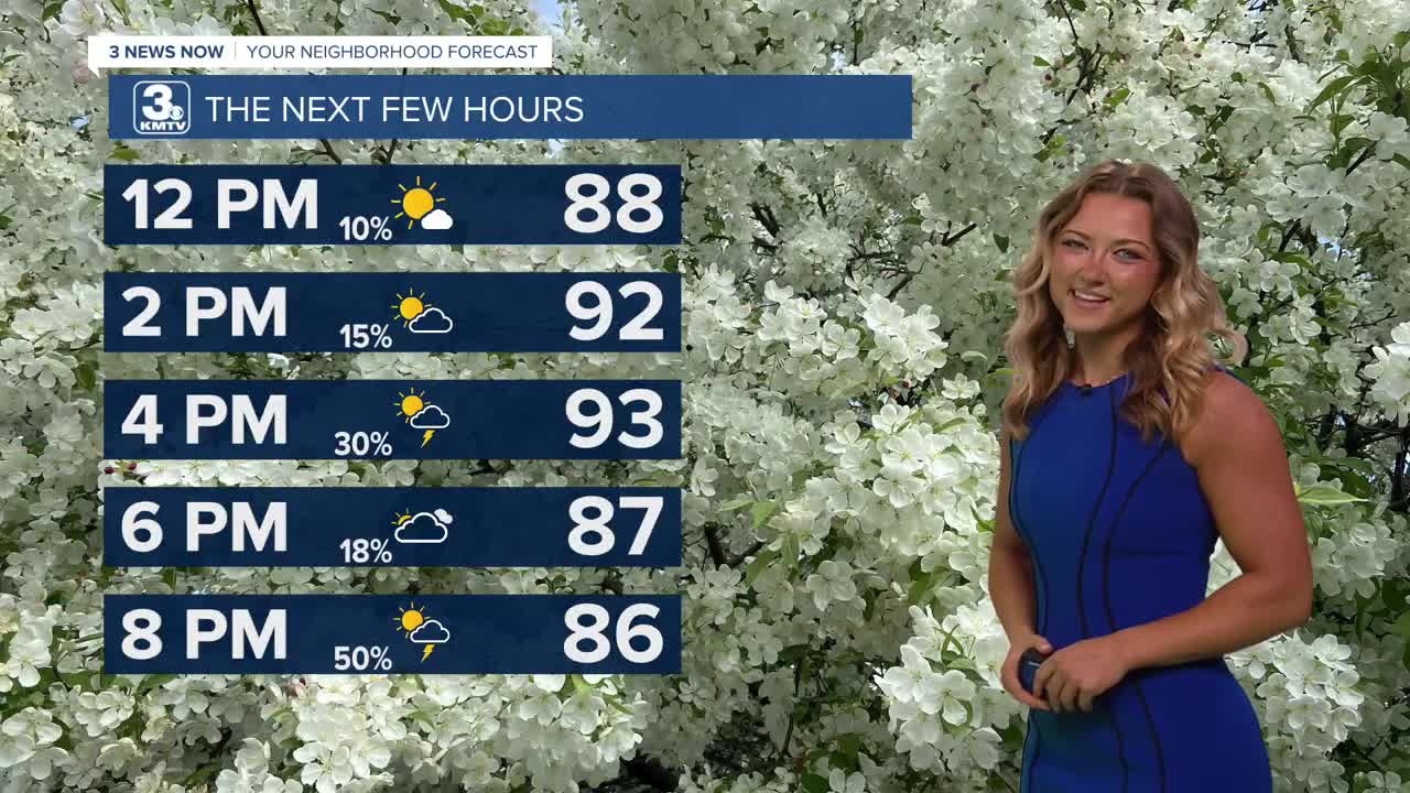
Our Wednesday is hit a little harder with the heat, temperatures will climb to the lower 90s by this afternoon. The humidity will be a little more noticeable as the day goes on, leading to a heat index of around 95+ late in the day. A few spotty rain and thundershowers will try and pop up after 2-3pm.
A cold front will begin to approach Omaha to the north Wednesday night, leading to a better chance for thunderstorms in the evening. More storms will approach Omaha from the west overnight. Some areas of gusty winds and pockets of large hail may be possible, but severe weather looks limited right now. That threat will mainly be in central Nebraska.
Thursday looks to be cloudy and milder with scattered rain off and on during the day. There will be plenty of dry-time after 9-10 AM though. Thanks to the clouds, temps will only reach the mid 80s.
We'll keep a small chance at rain around for Friday, but a lot of the day looks to be dry with partly sunny skies. Temps will be near average, around 88 degrees.
In total, there could be around 0.10" to 0.50" of rain from Wednesday through Friday. Some may see more, some may not see much rain at all.
Heading into the weekend, we are back to sunshine and warmer weather. Highs will be in the upper 80s Saturday, and low 90s on Sunday. The humidity shouldn't be too bad with dew points in the mid 60s.
The summer heat really begins to pick up heading into next week. Monday and Tuesday will be sunny with highs in the low to mid 90s. By the middle of next week, highs could climb back up into the mid to upper 90s. For now, the humidity does not appear to be exceptionally high, but could lead to afternoon heat indices in the 95-100 range every day of next week.
WEDNESDAY
Mostly Sunny
Late-Day Storms
High: 93
Wind: S 10-15
WEDNESDAY NIGHT
Stormy
Gusty Winds
Low: 72
Wind: S 15-25
THURSDAY
Lingering Storms
Cooler
High: 86
Wind: S 10-15
Share your weather pictures with KMTV:
- Email to News@3newsnow.com
- 3 News Now Facebook page
- Use the hashtag #3NewsNow on Instagram or X (formerly Twitter)
