
Light rain switching over to snow fills in more overnight. Most of this will stay southeast of the metro with some locations seeing light snow up to an inch.
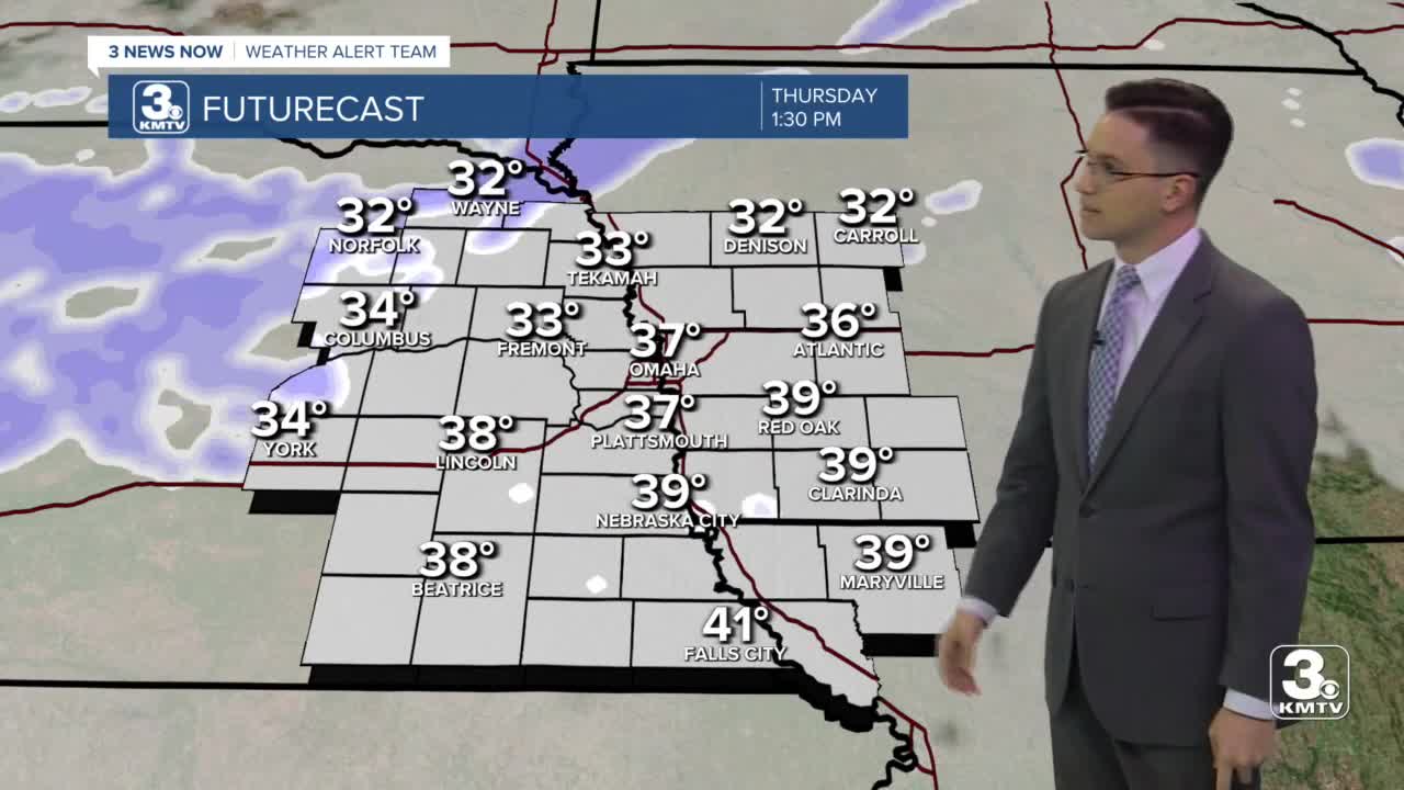
Thursday will be mostly cloudy, breezy, and colder with highs in the upper 30s. Late in the afternoon, our next batch of light rain and snow will start to push in from the northwest, first arriving in northeast Nebraska. Any rain will be first, with everything then changing into snow. The wintry mix will expand southeast towards I-80 Thursday night, then lastly overnight down towards northwest Missouri. The snow ends before the Friday morning commute. If any snow sticks to the ground, totals should stay under half an inch.
Friday will be the coldest day of the week, but we only dip down to more average temperatures for February. We start the day in the teens, then warm into the mid 30s for the afternoon with mostly sunny skies.
We pop back above average this weekend! Saturday could still be a little breezy, but with mostly sunny skies, we warm into the lower 50s. Sunday will also be great with low 50s continued.
Monday will kick off the work week with warmer air. Highs are back in the 50s.
The temperature trend will continue into the middle part of the week, but we add rain chances into the mix Tuesday and Wednesday.
THURSDAY
Mostly Cloudy
Breezy
High: 39
THURSDAY NIGHT
Mostly Cloudy
Light Rain/Snow
Low: 29
FRIDAY
Mostly Sunny
Average
High: 36
SATURDAY
Mainly Sunny
Warm
High: 50
Share your weather pictures with KMTV:
- Email to News@3newsnow.com
- 3 News Now Facebook page
- Use the hashtag #3NewsNow on Instagram or Twitter
Download the free Storm Shield app for ANY type of phoneReceive severe weather watches and warnings for your location as you track the storms on radar. Great for use at the office, at home, and while traveling.
