

3 THINGS TO KNOW
- Warmer weather makes its return starting Tuesday
- Rain & snow possible Wednesday
- Chilly again by this weekend
FORECAST
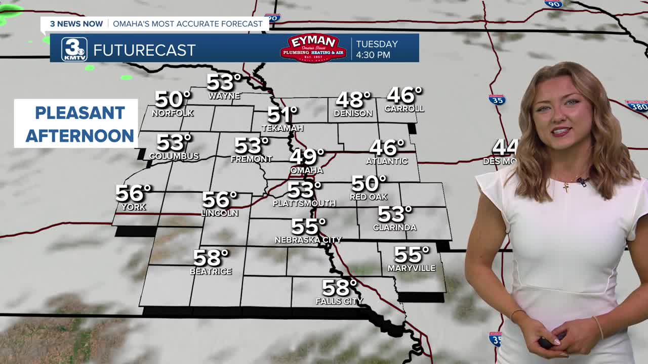
The afternoon looks to be a bit cloudier, which might hinder a lot of melting for previous snowfall. Temperatures seem to reach a gradient this afternoon, with areas to the south seeing the upper 50s, and areas to the north seeing the upper 40s for highs today.
Wednesday also starts out milder, but after 12pm, a rain and snow mix will move into the area from our north. From Omaha and points east, this rain and snow mix could lead some slushy roads and up to an inch of snow. If you are south or west of Omaha, this is likely just rain for you.
By Thursday, we are warming out from the cold again and with sunshine, reaching highs in the mid 50s.
Friday will be the warmest day out of this stretch, and looking like a great day with sunshine and highs in the mid 60s, with lighter winds.
By the weekend, it gets cold again...A cold front will move through Omaha late Friday night, and we drop into the 40s on Saturday, and the 30s on Sunday. There is a chance for additional snow Sunday and into Monday of next week.
TUESDAY
Mostly Cloudy
Warmer
High: 49
Wind: NW 15-20
TUESDAY NIGHT
Partly Cloudy
Steady Temps
Low: 25
Wind: NW 5-10
WEDNESDAY
Mostly Cloudy
Rain & Snow after 12pm
High: 45
Wind: SE 10-15
Share your weather pictures with KMTV:
- Email to News@3newsnow.com
- 3 News Now Facebook page
- Use the hashtag #3NewsNow on Instagram or X (formerly Twitter)
