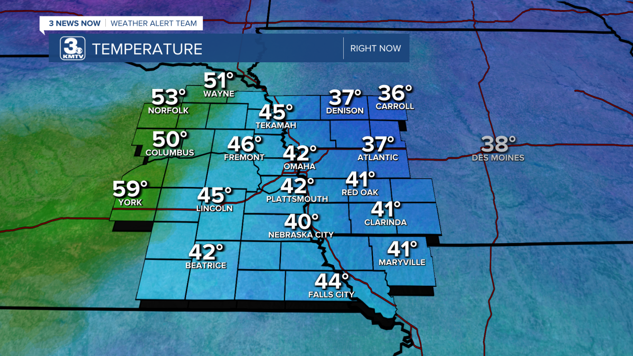
Our next blast of Arctic air is on its way! (As of my writing this early Tuesday afternoon, at least.) Temperatures around 3 pm today are the warmest we will be until about Saturday afternoon. Temperatures themselves range from the mid to upper 30s in northwestern Iowa to 40s, 50s, and almost 60 degrees Fahrenheit in York!
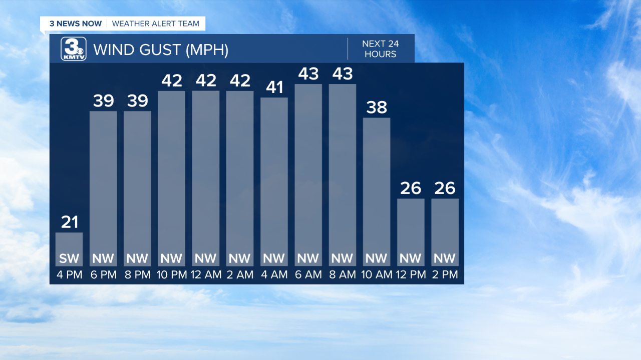
With the arrival of the cold front this evening, temperatures will plummet, and northwest winds will really crank up. Actual temperatures will fall into the single digits in Omaha with a wind chill well below zero again, near –15 degrees. It will be even colder up north, and wind chills across eastern Nebraska and western Iowa will range from –10 to –30 degrees.
The northwest winds will be a 'blowing! We’ll see them pick up around 6-7 pm and we will see strong wind gusts in our area up to around 45-50 mph. While the winds will back off a bit during Wednesday, gusts will still be 20-30 mph in the afternoon.
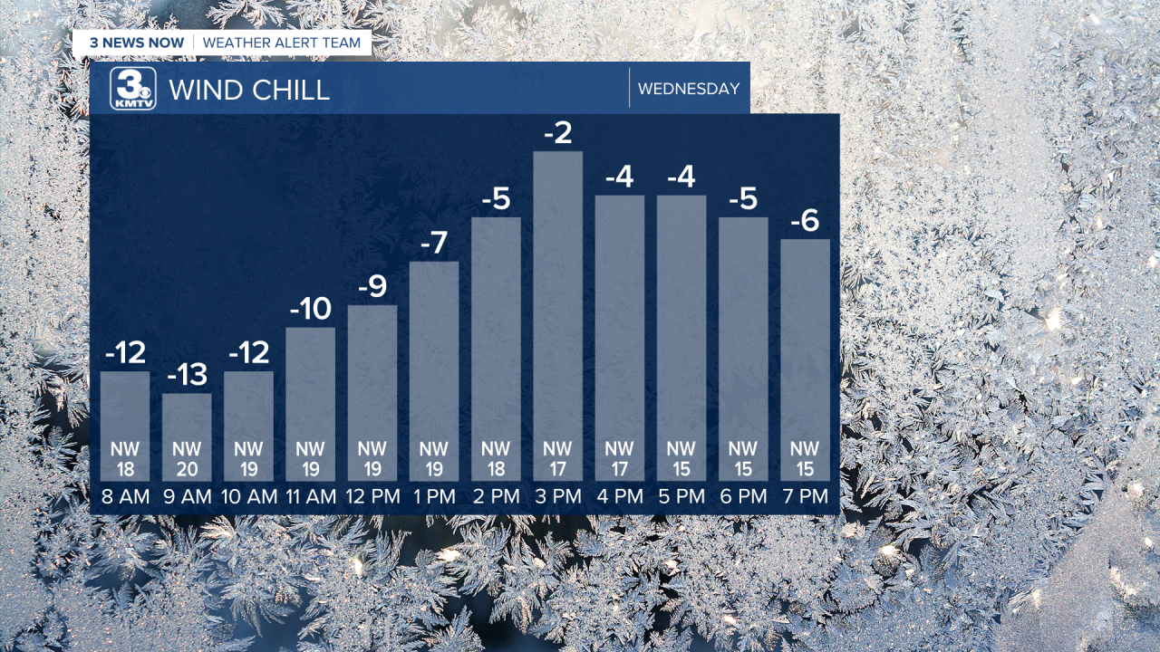
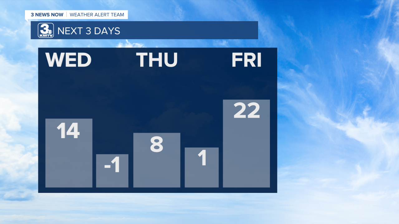
The cold will settle in for a few days, too. Wind chills aren’t expected to get above 0 degrees on Wednesday and actual temperatures will only warm into the low teens. We’re looking at single digit highs on Thursday before a slight warm up into the low 20s on Friday.
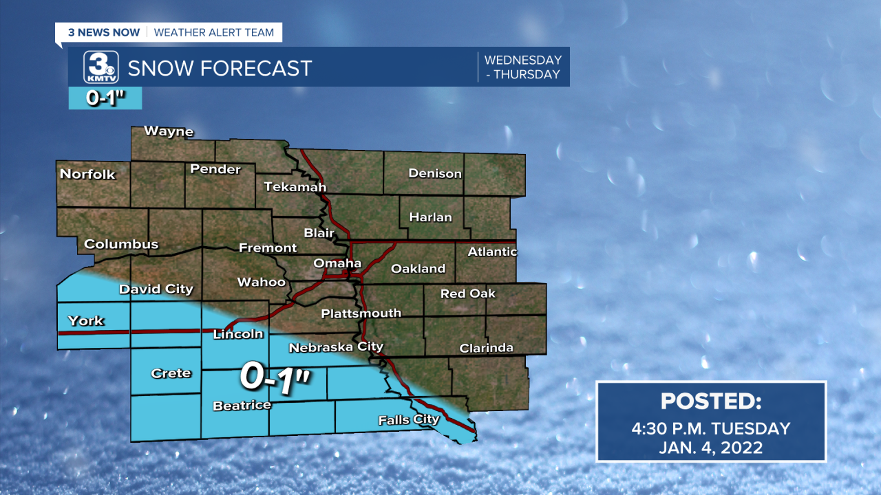
While some light snow is possible late Wednesday into Thursday, the bulk of it looks to stay much farther to our south with Omaha only seeing a few flurries and no accumulation. Any accumulation would be down south, closer to the Nebraska/Kansas border and even that would be an inch or less.
Stay safe and warm out there!
