We’ve gotten through winter relatively unscathed so far here in eastern Nebraska and western Iowa. Plenty of snow? Yes. Lots of cold? Not so much. That changes as we head into and through this upcoming weekend.
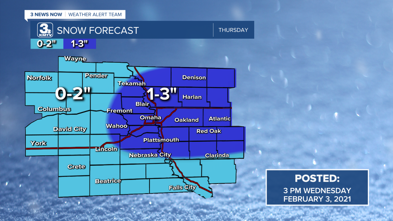
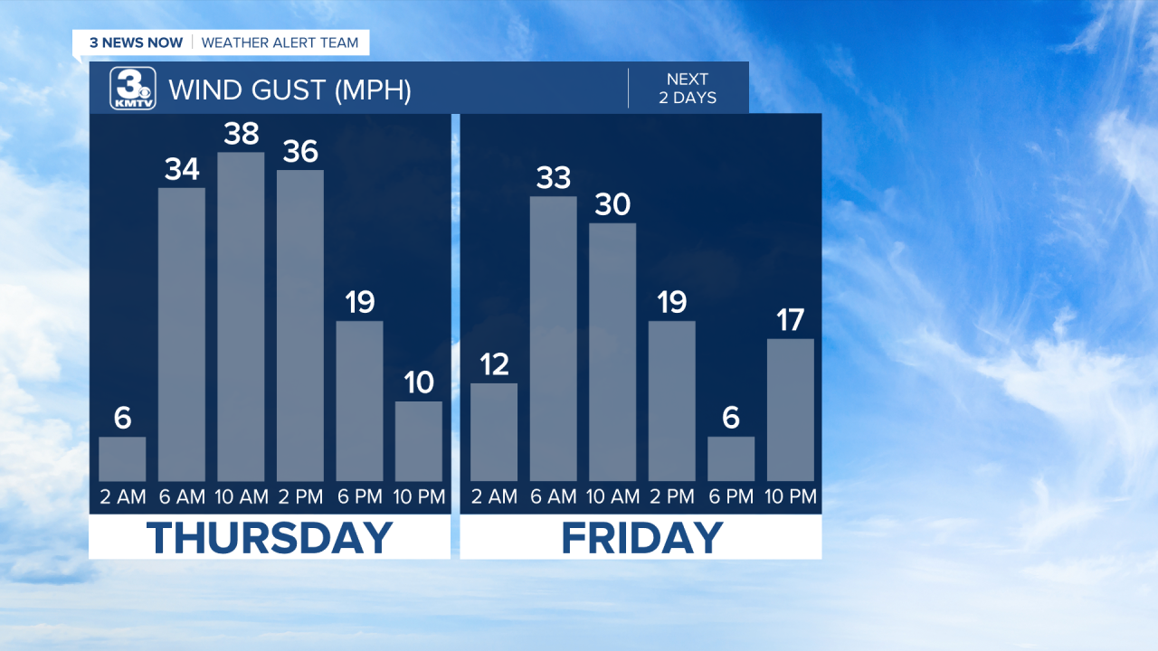
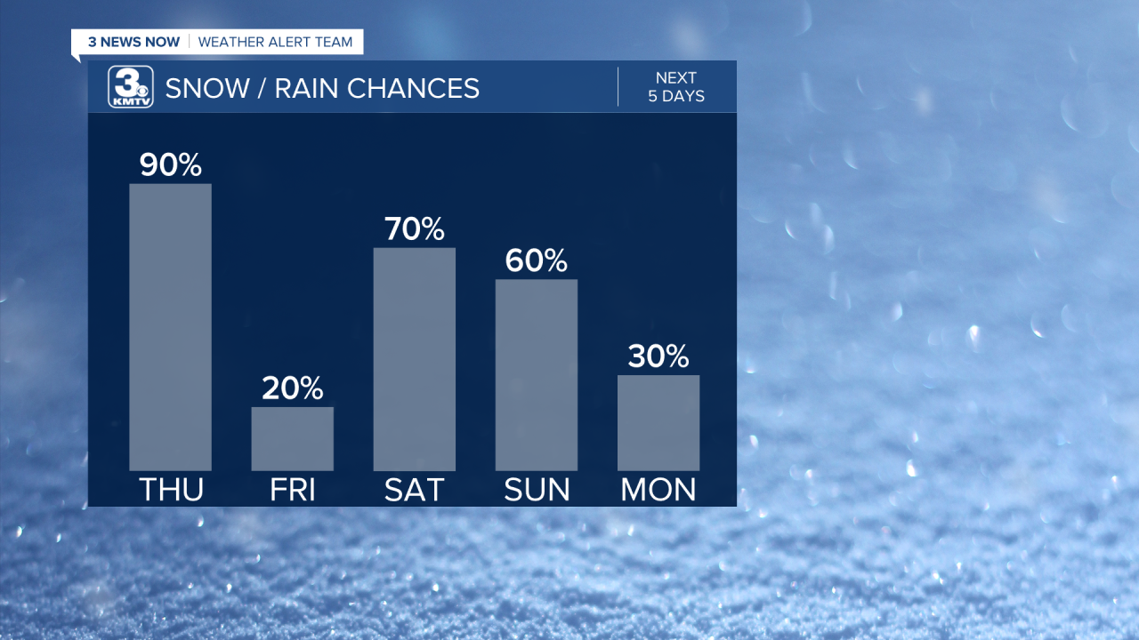
Our first cold front arrives Thursday morning and brings snow and wind with it. This opens the door for our first shot of cold air, but a reinforcing blast arrives on Friday and oooh goodness does it get frigid afterwards! Aside from the accumulating snow and wind gusts, temperatures will drop, and they just keep dropping. By the time we get to the weekend, highs on Saturday will be in the mid-teens, and then struggle to make it into the double digits on Sunday.
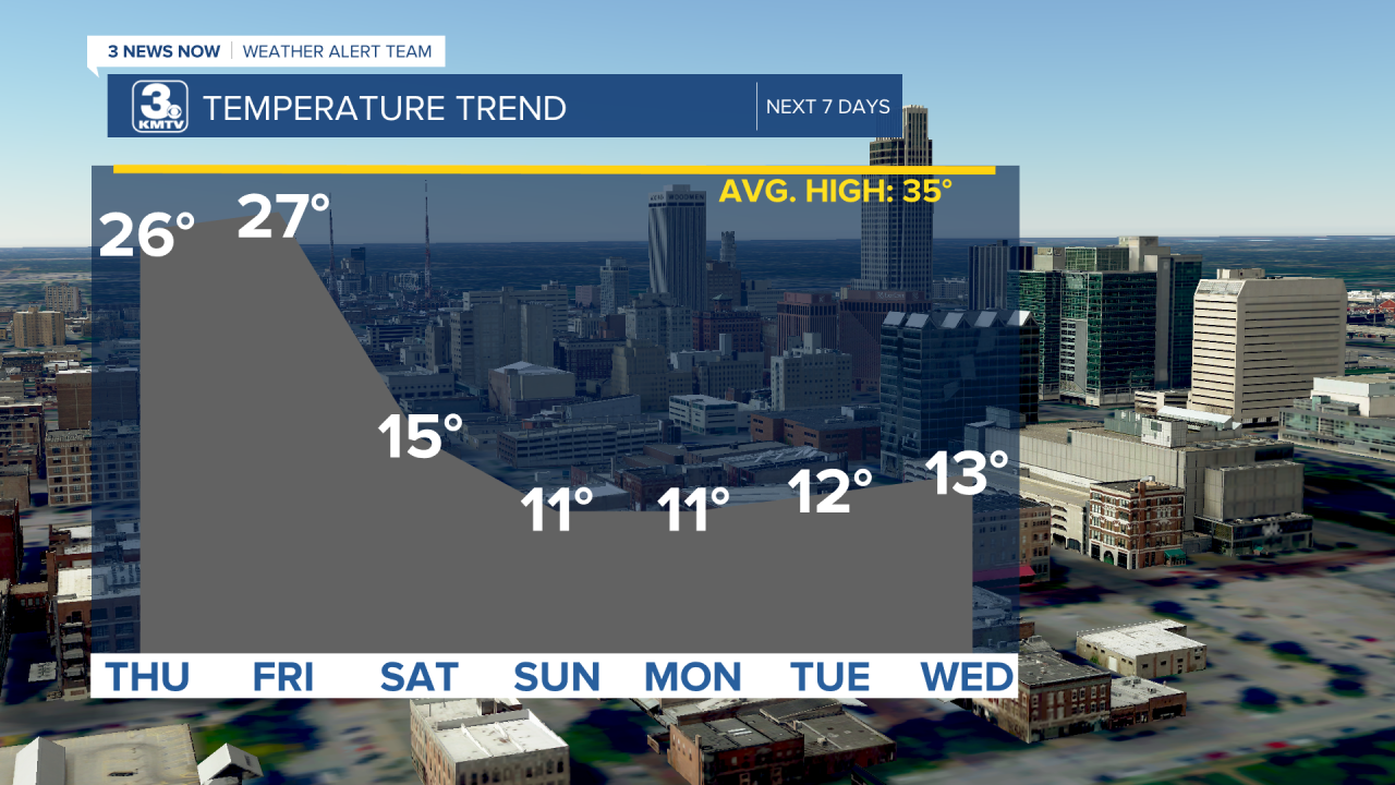
Once this cold air settles in, it’s going to be sticking around for a while, and the active weather pattern just continues. We've got a few chances for more accumulating snow coming up over the next several days!
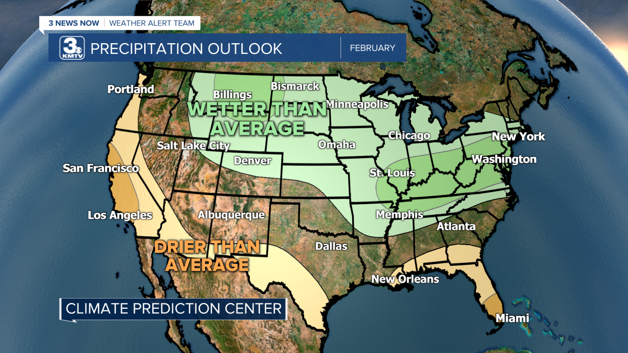
Overall, it looks like the month of February will be a cold one, as the Climate Prediction Center keeps much of the northern half of the US in the colder than average range.
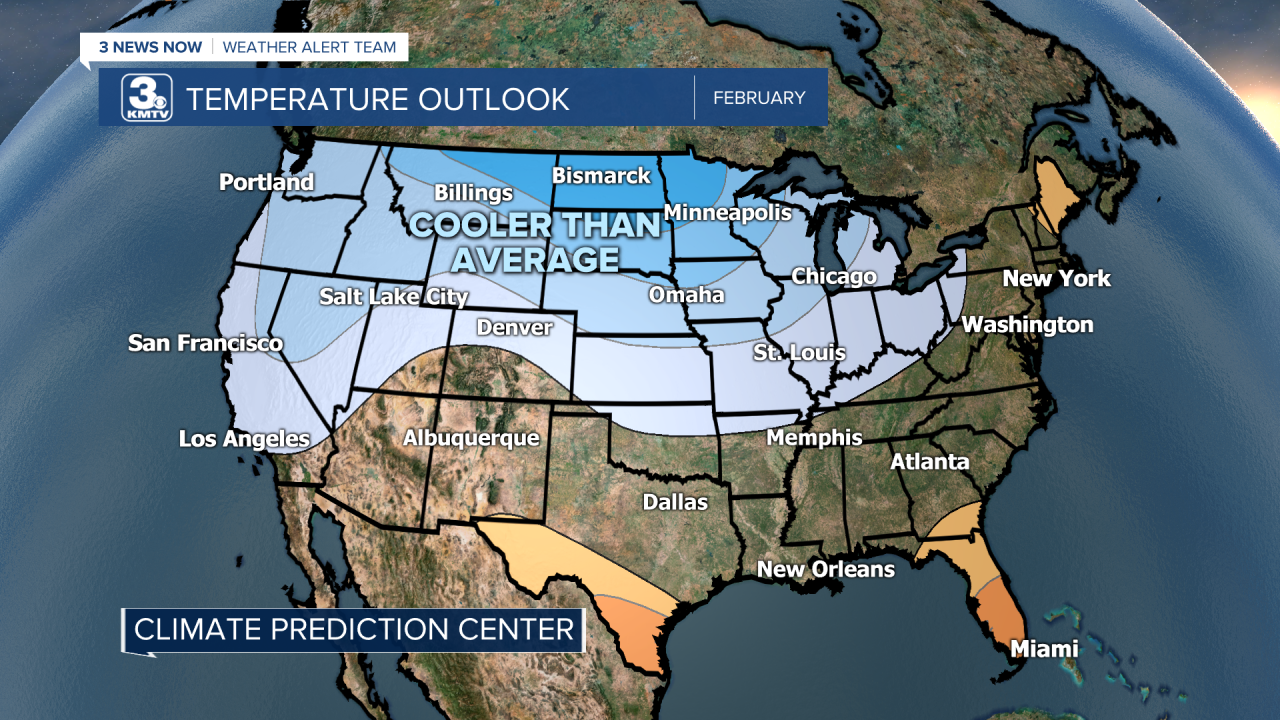
It could mean more snow for us, too, since the CPC also shows much of the same area in the wetter than average category for precipitation.