While it might feel like summer is winding down as many get ready to head back to school during August, temperatures stay mostly summer-like during the month.
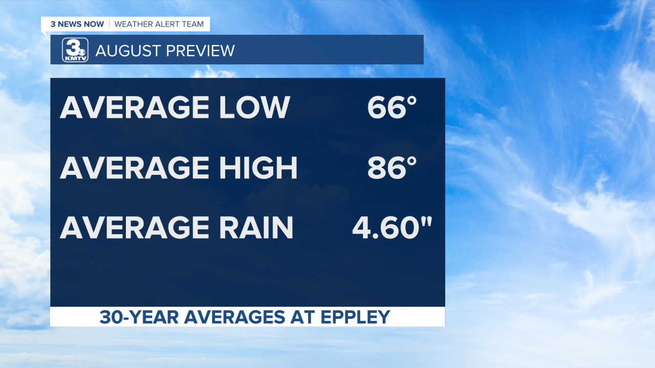
Let’s check out some of our averages for the month of August. Temperatures stay warm with an average high of 86 degrees. Morning temperatures are also fairly warm, with an average low of 66 degrees. Although it’s not our rainiest month, it is our second rainiest month with an average of 4.60 inches of rain. It’s just below the May average (our rainiest month) of 4.66 inches.
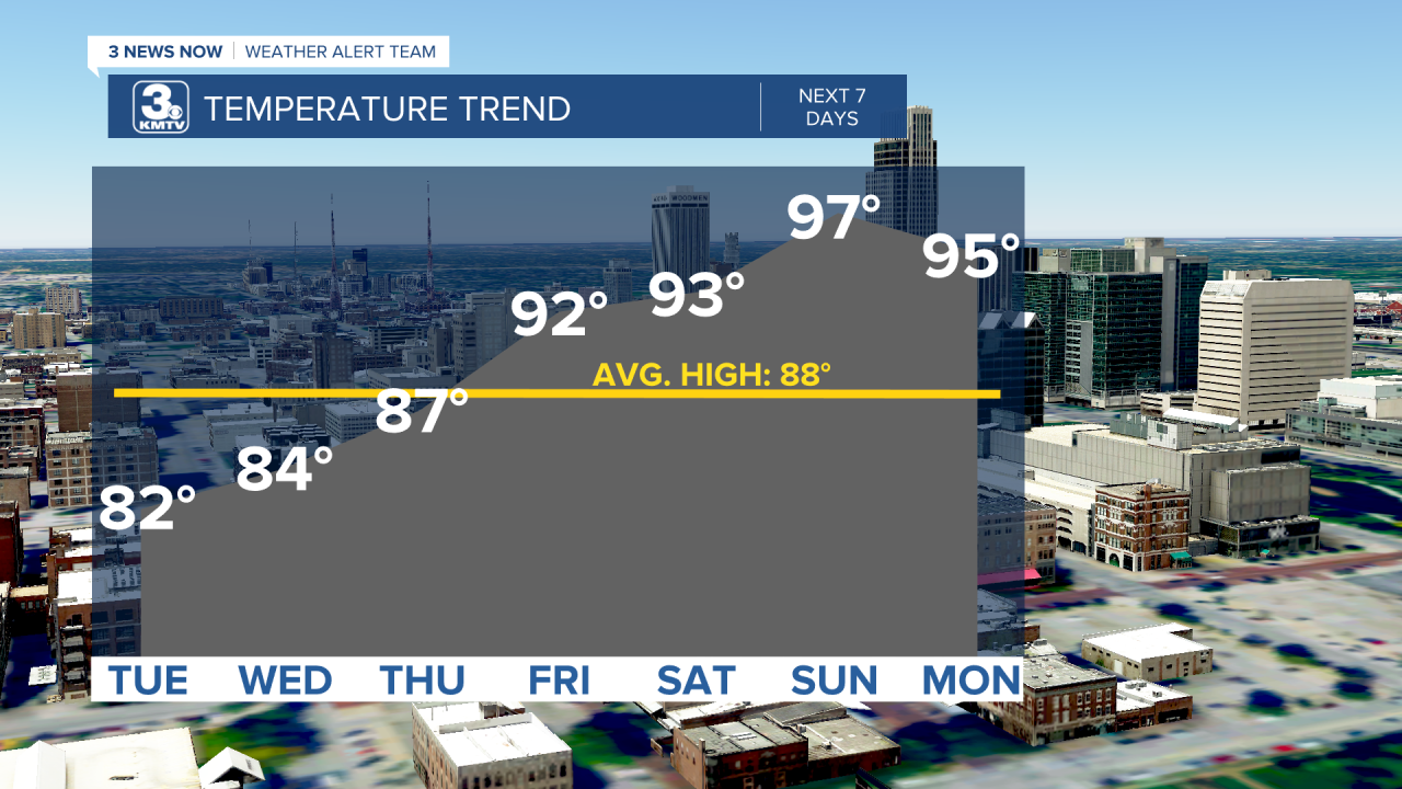
For the first part of August, our temperatures started just below average. This won’t last too long though, as we warm back up for the rest of this week. In fact, we’ll back to highs in the 90s sooner rather than later, which is back above average for this time of the year.
In general, it looks like we’ll be experiencing above average temperatures for the bulk of the month, according to the Climate Prediction Center. Most of the northern half of the US will see better chances for warmer than average temperatures for the month, so Nebraska and Iowa are not alone! Some cooler than average temperatures are a bit more likely down south through parts of Texas, Oklahoma, Louisiana, and Arkansas.
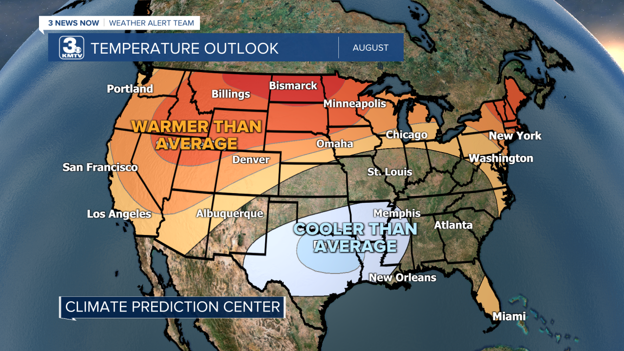
As for precipitation, the CPC shows drier than average conditions more likely for parts of northeastern Nebraska and northwestern Iowa. Omaha is right on the edge of that. Wetter than average conditions are a bit more likely to our southeast and southwest, but the bulk of the US sees about equal chances for wetter or drier than average conditions.

