In an unsurprising fashion, we have reached the point in July where our weather in eastern Nebraska and western Iowa is generally hot and dry. And muggy. Can’t forget that part! While we’re currently above average on our precipitation amounts, that will quickly come to an end...
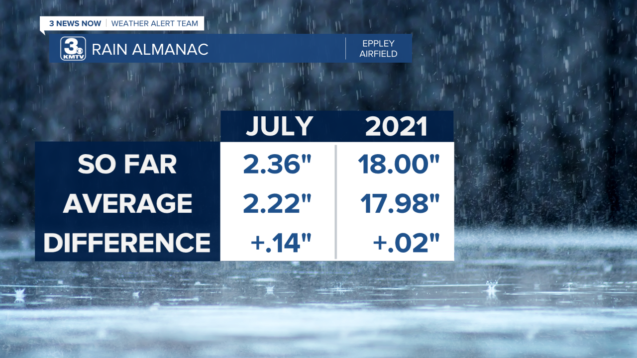
While, technically, we’re above average on our rainfall amounts for both the month of July and the year, it’s by the smallest amount: 0.14 and 0.02 inches, respectively, as of Monday, July 19th.
As you might guess, that will soon drop to being below average since we are expecting it to be a pretty dry week ahead. Our drought monitor data from last Thursday shows “None” or “Abnormally Dry” conditions across most of eastern NE and western IA with a few spots reaching the “Moderate” drought category. I would expect to see this change on Thursday with the newest update to likely show some more “Abnormally Dry” conditions creeping into some parts of the area.

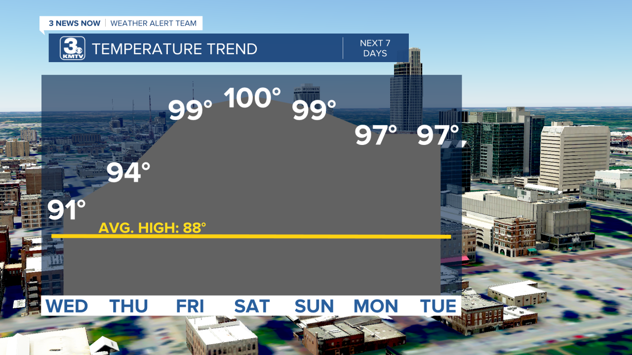
Afternoon highs are going to hit the 90s again this week and it looks to be a while before we drop into the 80s again. In fact, we could even hit the triple digit mark!
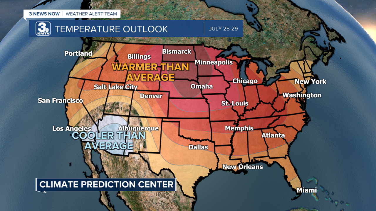
Looking ahead past this week and to the end of the month, it looks like we’ll keep around this hot and dry pattern for a while. The Climate Prediction Center shows warmer than average conditions across most of the United States.
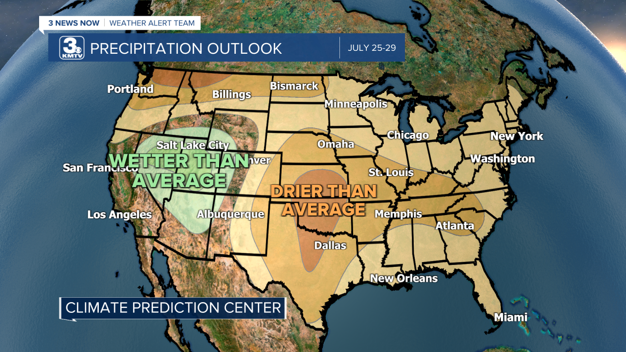
For the same time frame, the CPC shows drier than average conditions for most of the US aside from part of the West and a small part of the New England area. Of course, that doesn't mean we won't see any more rain throughout the rest of the month, we are just more likely to stay "below average."