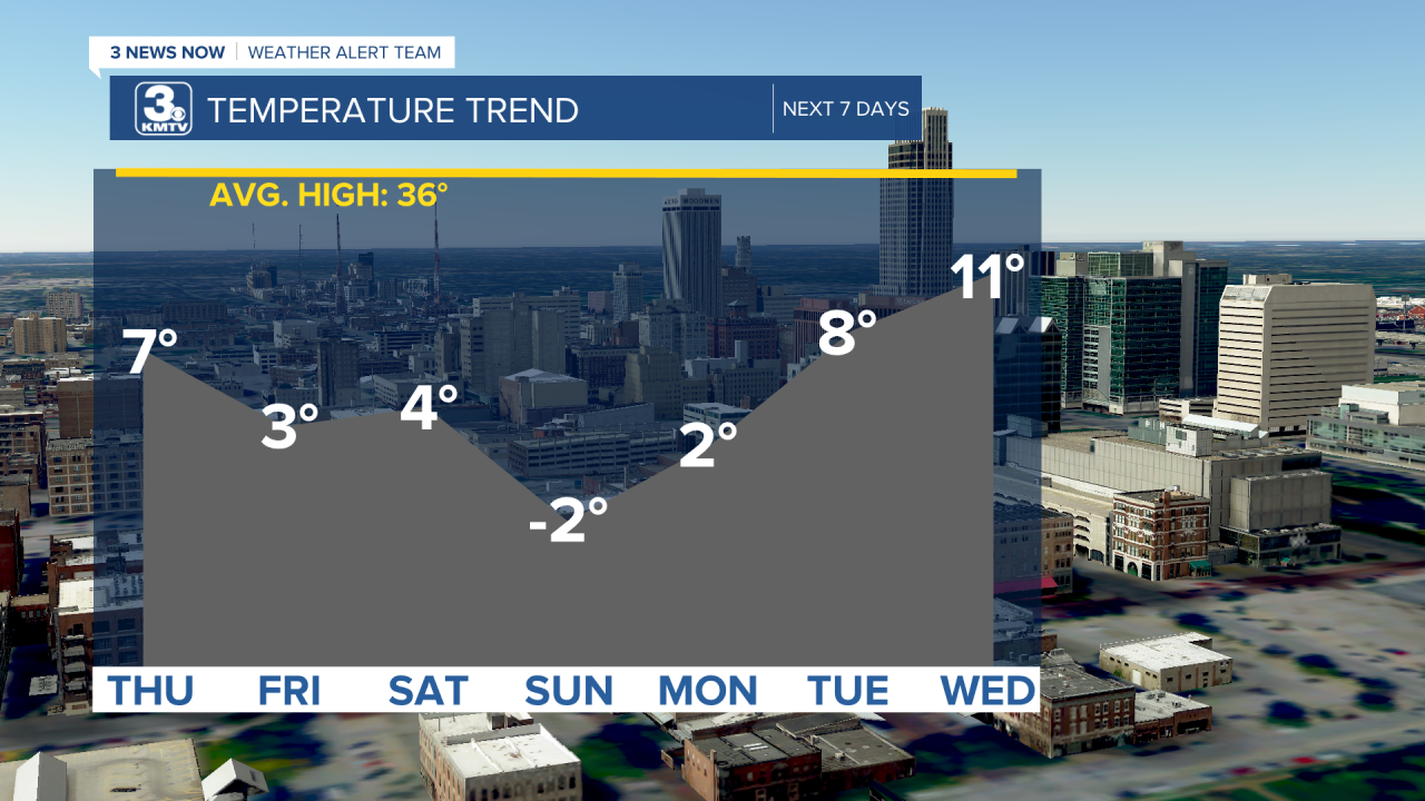
To say it has been cold lately would be...an understatement. It’s been downright bone-chilling, frigid, bitterly cold, and dangerously cold. After our brief “warm up” on Wednesday, it’s back into the deep freeze.
Temperatures will be back down in the single digits for afternoon highs for essentially the next 7 days. On Sunday (Valentine’s Day), we likely won’t even warm to over 0 degrees. Of course, wind chills are even colder, with many mornings seeing wind chills near –20 degrees or worse. We’ve got a couple days where we could potentially set some new records for cold temperatures.
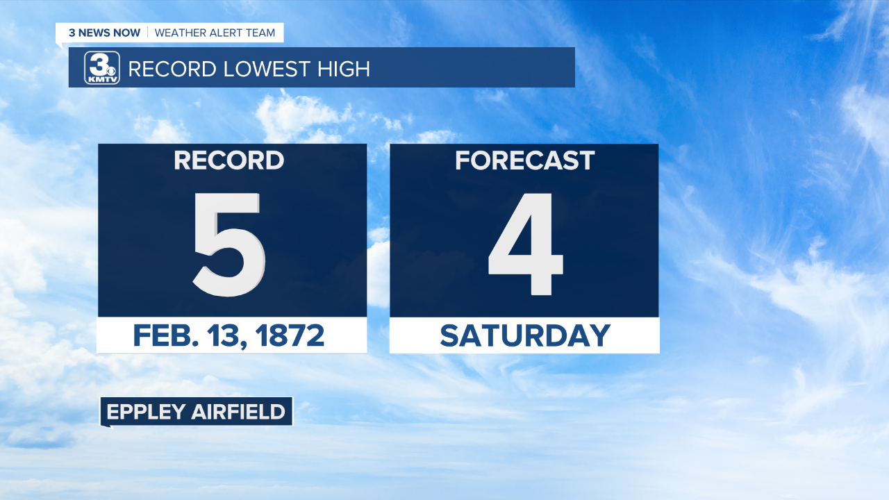
Here’s our record outlook for this Saturday, February 13th. The record lowest high for the day (think coldest high), is 5 degrees set back in 1872. We’re forecasting a high of 4, so it’ll be close!
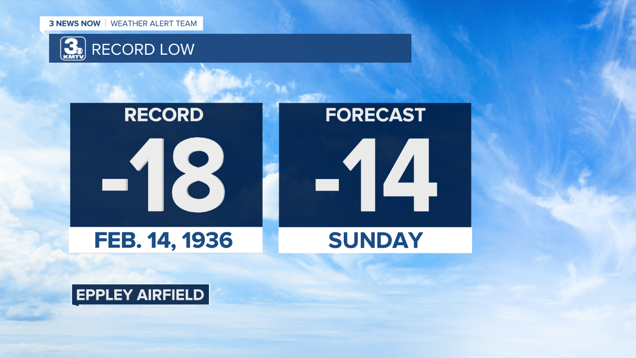
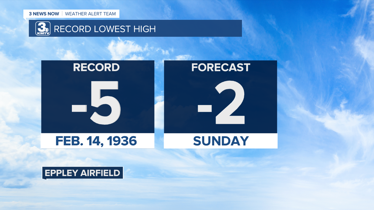
Moving to February 14th records... The record low for the day is –18 degrees, set in 1936 and record lowest high is – 5 degrees, also set in 1936. We’re forecast a low of –14 degrees Sunday morning and a high of –2 degrees. These records aren’t quite as close, but with snow on the ground and a reinforcing blast of Arctic air, it’s not impossible! Keep in mind, wind chills on Sunday morning will likely be between –30 to –40 degrees.
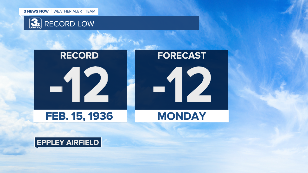
The record low for February 15th is –12 degrees which is the same as our current forecast.
Stay up to date on the forecast to see if we break or tie any records and make sure you’re staying warm during this dangerous cold!
