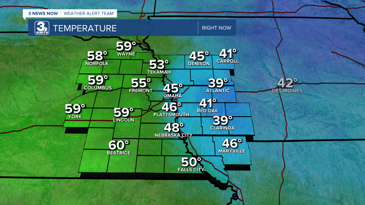
It’s January 18th which isn’t notorious for being a “warm” time in eastern Nebraska or western Iowa, but we had some warm temperatures out there today ahead of the cold front.
In fact, a good majority of eastern Nebraska was nearing the 60-degree mark around 1:00 this afternoon! Unfortunately, Omaha wasn’t one of those cities. We were still warmer than our average high for today of 33 degrees, but our temperatures along with those in western Iowa were being held back by the snow on the ground.

By looking at a map showing temperatures around 2 PM and our current snow depth, you can see how these colder cities still have anywhere from one to about four inches of snow on the ground.


Of course, snow is cold, so that makes sense, but what’s the scientific explanation for all of this?
Well, let’s get into it. During the day, sunlight reaches the Earth’s surface and as the ground warms it then begins to return some of that heat back into the air around it. That happens easily when sunlight can directly hit the dirt and grass. However, when you put snow on top of the ground, this process changes and the solar heat escapes back into the atmosphere instead of sticking around to warm up the air closer to the surface where we are. What little heat does stick around closer to the surface is focused on melting the snow.
As sunlight hits snow, it bounces off the snow and can’t reach the ground underneath to begin warming. Sunlight bounces off the snow because its color, white, has the highest albedo. Albedo describes how much or how little solar energy is absorbed. While white snow is on one end of the albedo spectrum (which runs from a scale of 0 to 1), a black surface is at the other end of the spectrum. To better understand that, think about how you avoid stepping on a blacktop road, parking lot, or similar surface with your bare feet in the summer because it’s too hot!


